
Your partner for contemporary agricultural techniques is the 40Pro Agricultural Drone. With the help of this sophisticated drone’s cutting-edge sensors and high-resolution image technologies, you may collect precise aerial data required for precision agriculture.
Its GPS-powered autonomous flight and precise positioning capabilities provide accurate data collecting and analysis. Longer flight times allow you to complete missions that span greater agricultural areas.
Click here for more info.
VFLYX Series V1 (Surveillance Drone)
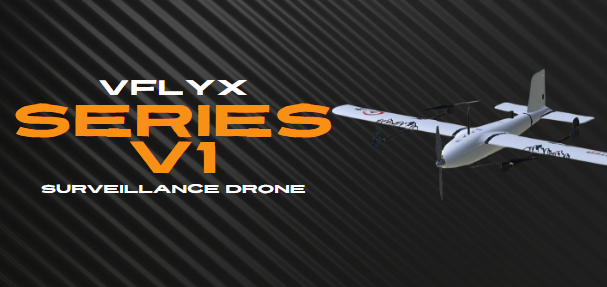
Designed for rapid response and flexibility, the VFLYX Series V1 can achieve impressive speeds in horizontal flight. Its aerodynamic design and advanced propulsion systems ensure high-performance maneuvers, making it well-suited for air-to-air combat and ground attack missions.
Click here for more info.
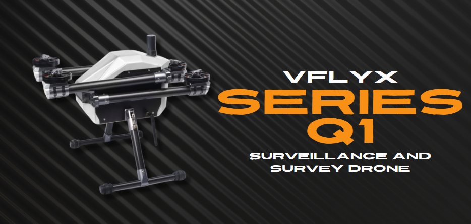
VFLYX Series Q1 (Surveillance & Survey Drone)
The VFLYX Quadcopter Series 1, a groundbreaking line of drones that redefine the skies with unparalleled performance and cutting-edge technology. Designed with precision engineering and innovation at its core, the Series 1 drones boast an exceptional flight time of 90 minutes, setting a new standard for extended aerial exploration.
Click here for more info.
VFLYX series VT01
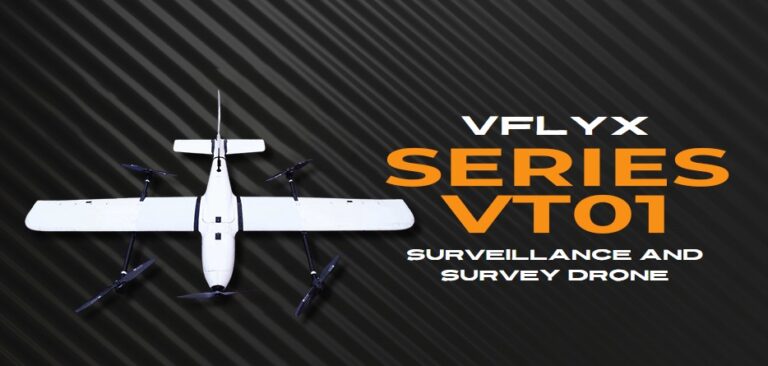
VT01 combines vertical takeoff with fixed-wing efficiency through a robust puller quadcopter VTOL design. Operate confidently in tight 6m x 6m areas, then transition seamlessly to long-range flight. Rely on high-endurance electric motors and a custom battery system to extend your mission time. Achieve stable, precise navigation with triple-redundant IMUs and industrial-grade RTK GNSS. Handle harsh environments with 5 m/s wind resistance and a 5000-meter service ceiling.
Click here for more info
Read More About VFLYX Agri Drones
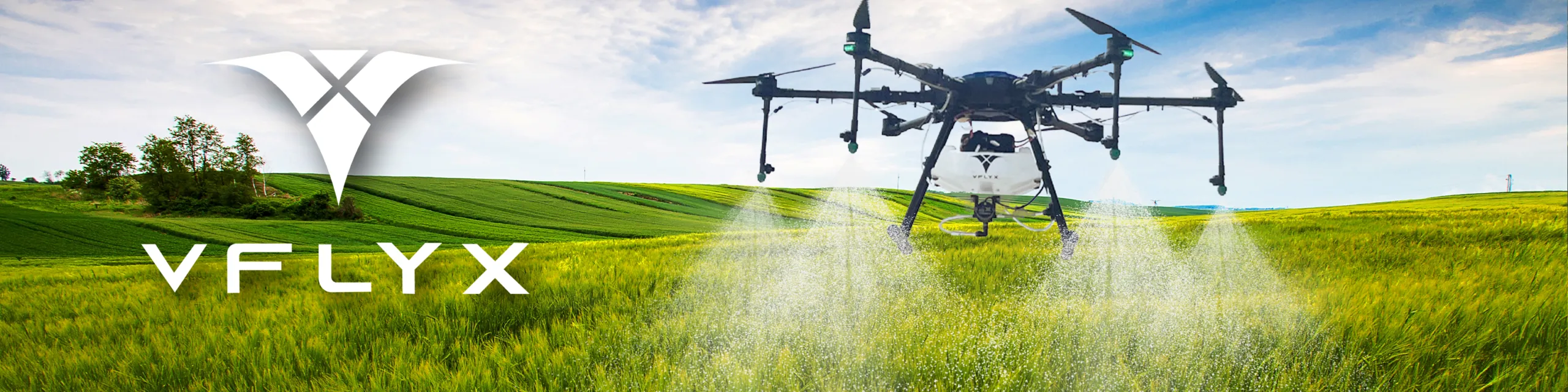
Welcome to our comprehensive guide on VFLYX Agriculture Drones on Xboom.in, where we delve into the innovative world of drones designed specifically for agricultural use. With the focus on enhancing farming efficiency, precision, and productivity, agriculture drones have revolutionized traditional farming methods, offering a new dimension of agricultural management.
Introduction to VFLYX Agriculture Drones
VFLYX Agriculture Drones, a pivotal innovation in modern farming, are unmanned aerial vehicles (UAVs) tailored to meet the diverse needs of the agriculture sector. From high-resolution aerial photography for crop monitoring and health assessment to precision spraying of pesticides and fertilizers, these drones provide invaluable data and services that significantly contribute to sustainable agriculture practices.
The Significance of Agriculture Drones in Modern Farming
Agriculture drones, including the VFLYX Agriculture Series V1, VFLYX Agriculture Series Q1, and VFLYX Agriculture 40L HD540 Pro, offer a myriad of benefits that address the complexities of modern agriculture. They enable farmers to make informed decisions based on accurate, real-time data, resulting in optimized crop yields, reduced waste, and minimized environmental impact.
Key Models and Their Features
- VFLYX Series V1 (Surveillance Drone): Designed for surveillance and monitoring, this drone is equipped with advanced imaging capabilities to provide detailed insights into crop health, irrigation needs, and pest detection.
- VFLYX Agriculture Series Q1 (Surveillance & Survey Drone): This model excels in both surveillance and surveying, offering precise 3D mapping and terrain analysis, which are critical for land management and planning.
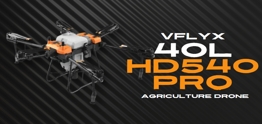
- VFLYX 40L HD540 Pro Agricultural Drone: A standout for its large capacity, the 40L HD540 Pro is specifically engineered for aerial spraying, capable of covering extensive areas with high efficiency and accuracy.
Why Choose Agriculture Drones?
Agriculture Drones like the VFLYX Agri Drone and VFLYX Spraying Drone are indispensable tools for farmers seeking to embrace precision agriculture. They not only enhance crop management through detailed aerial imagery but also significantly reduce the time and labor involved in traditional farming practices. By integrating drones into their operations, farmers can achieve:
- Increased Crop Yields: Through precise monitoring and targeted treatment.
- Resource Efficiency: Minimizing the use of water, fertilizers, and pesticides.
- Cost Reduction: Lowering the overall operational costs associated with manual labor and machinery.
- Sustainable Farming Practices: Promoting environmental conservation by reducing chemical runoff and optimizing land use.
Purchasing Agriculture Drones in India
For those interested in integrating drone technology into their agricultural practices, Xboom.in provides a seamless purchasing experience. Whether you’re looking for the VFLYX Farming Drone or any Agriculture Drone, we offer a wide selection to meet your specific needs. Our platform ensures that you get the best Agriculture Drone Price in India, along with expert guidance to select the right model.
Conclusion
The advent of Agriculture Drones has opened up new vistas for enhancing agricultural productivity and sustainability. With models like the Agriculture Series V1, Agriculture Series Q1, and the Agriculture 40L HD540 Pro, Xboom.in is committed to offering the best in drone technology to the Indian agriculture sector. Embrace the future of farming with our cutting-edge drones and transform your agricultural practices with precision, efficiency, and sustainability.
Discover the ideal Agriculture Drone to elevate your farming operations and enjoy competitive pricing, unparalleled support, and the assurance of quality with Xboom.in. Explore our range today and take the first step towards a more productive and sustainable agricultural future.
FAQ's About VFLYX Agri Drones
What are Agriculture Drones?
Agriculture Drones are advanced UAVs specifically designed for farming and agricultural purposes. They assist in various tasks such as crop monitoring, aerial spraying, and field surveying, enhancing efficiency and productivity in farming operations.
How can Agriculture Drones benefit my farming operation?
By utilizing Agriculture Drones, you can achieve precise crop monitoring, efficient pesticide application, and detailed land analysis. This leads to better crop management, reduced waste, and lower operational costs, ultimately increasing yield and profitability.
What models of Agriculture Drones are available on Xboom.in?
Xboom.in offers a variety of models including the Agriculture Series V1, Agriculture Series Q1, and the Agriculture 40L HD540 Pro, each designed to meet specific needs in surveillance, surveying, and agricultural spraying.
Can Agriculture Drones be used in all types of crops?
Yes, Agriculture Drones are versatile and can be used across a wide range of crops. Their adjustable settings and customizable flight plans make them suitable for different types of agricultural land and crop requirements.
What is the flight time of an Agriculture Drone?
The flight time varies by model, but drones like the Agriculture 40L HD540 Pro offer extended flight times suitable for covering large areas, maximizing the efficiency of each operation.
Are Agriculture Drones difficult to operate?
While advanced in technology, Agriculture Drones on Xboom.in are designed with user-friendly interfaces. Even those new to drone technology can learn to operate them effectively with minimal training.
How much do Agriculture Drones cost?
The price of Agriculture Drones varies based on the model and specifications. Xboom.in offers competitive pricing on all models, including the Agriculture 40L HD540 Pro. For specific prices, please visit our website or contact our sales team.
Is training provided for first-time Agriculture Drone users?
Yes, Xboom.in provides comprehensive training sessions for first-time users to ensure you can confidently and safely operate your Agriculture Drone.
Can I buy Agriculture Drones online in India?
Absolutely, Xboom.in makes it easy to purchase Agriculture Drones online in India. We offer a seamless buying experience, expert advice, and after-sales support to ensure you find the perfect drone for your needs.
What after-sales support does Xboom.in offer for Agriculture Drones?
Xboom.in prides itself on exceptional after-sales support, including technical assistance, maintenance services, and a warranty on Agriculture Drones. Our team is committed to ensuring your drone continues to operate efficiently post-purchase.
Applications of VFLYX Agriculture Drones: Elevating Precision Farming
- Precision Crop Spraying
To begin with, the VFLYX Agriculture Drone applies pesticides and fertilizers with unmatched precision. It significantly reduces chemical use, minimizes environmental impact, and lowers costs. For example, the drone targets specific areas affected by pests or diseases, applying chemicals only where needed. - Crop Monitoring for Health and Growth
Next, regular drone monitoring helps identify crop health issues and track growth patterns. The drone captures high-resolution images that farmers analyze to detect early signs of stress, nutrient deficiency, or water scarcity. As a result, farmers can intervene quickly and effectively. - Irrigation Management and Control
Meanwhile, the drone’s thermal imaging maps out moisture levels across fields. Farmers use this data to pinpoint overwatered or under-watered zones. Consequently, they adjust irrigation systems to use water more efficiently, promoting conservation and healthier crops. - Soil Health Analysis
Before planting, farmers deploy VFLYX Agriculture Drones to collect vital soil data, including texture, moisture, and composition. This information supports smart decisions about crop selection, planting layouts, and soil treatments to boost fertility and yield. - Planting and Seeding
In addition, some VFLYX drone models handle direct seeding by accurately dispersing seeds over prepped soil. This approach reduces labor, ensures better seed-to-soil contact, and often improves germination rates. - Livestock Monitoring
Farmers also rely on VFLYX drones for livestock management. These drones monitor health, movement, and grazing activity while quickly scanning large pastures. As a result, farmers can locate missing animals and detect injuries more efficiently. - Yield Estimation
Moreover, aerial imagery from VFLYX drones helps estimate crop yields before harvest. With this data, farmers plan better for storage, sales, and marketing, ultimately maximizing their profits. - Weed Detection
Then, advanced imaging sensors on the drone detect weed infestations early. This enables targeted control measures that protect crop health and maintain optimal yield. - Field Mapping and Surveying
Furthermore, VFLYX Agriculture Drones create accurate 3D maps of farmland. These maps provide insights into terrain, field boundaries, and soil conditions, helping with planning layouts, drainage systems, and irrigation infrastructure. - Data Collection for Farm Management Systems
Finally, VFLYX drones collect valuable data and sync with farm management platforms. This integration gives farmers real-time insights into crop health, soil status, and more—streamlining operations and supporting better decision-making.
