Description
Introducing UgCS Professional Desktop Drone Flight Planning Software
UgCS (Universal Ground Control Software) is the ultimate solution for creating and executing complex automated drone flights. Specially designed for professionals, it supports mission planning for LiDAR, photogrammetry, and various other aerial surveys. With the ability to import data from KML/CSV files and customize digital elevation models (DEM), UgCS simplifies flight planning, even in challenging terrain. This software is compatible with most popular drone platforms, offering a complete offline experience for maximum reliability in field operations.
Features
- LiDAR Surveys: Seamless planning of LiDAR missions with automatic IMU calibrations for precise data capture.
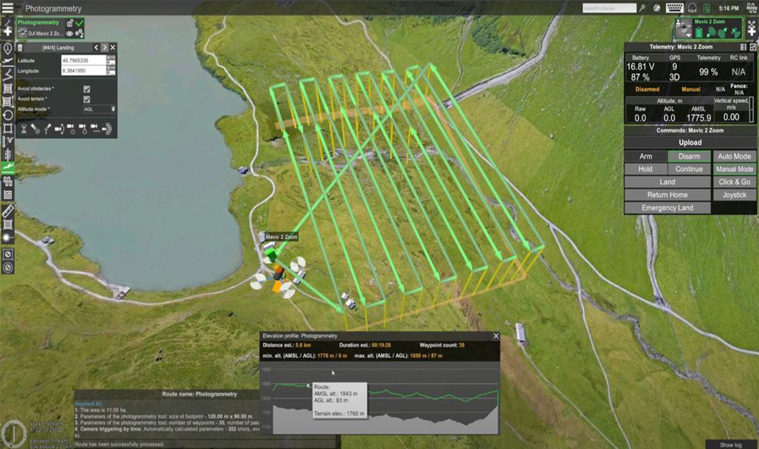
- Photogrammetry & Scanning Tools: Built-in photogrammetry, corridor, and vertical scan tools for accurate aerial mapping.
- 3D Terrain Following: Plan your flights in full 3D, ensuring drones follow complex terrains with ease.
- Digital Elevation Models (DEM): Customize your elevation models and overlay maps for advanced mission planning.
- Offline Installation: UgCS installs locally and operates offline, offering flexibility in remote or disconnected areas.
- Drone Compatibility: Supports a wide range of popular drones, making it a versatile choice for any drone operator.
Applications
Vertical Inspections
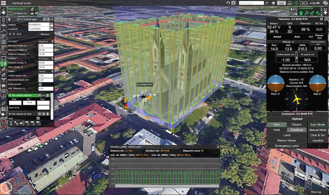
The UgCS automatic Vertical scan tool is designed for drone photography of vertical objects like building facades, bridges, chimneys, and open-pit walls. This tool automates surveys, capturing images with forward and side overlap that can be stitched into a vertical orthomosaic, ideal for detecting defects like cracks and conducting thermal inspections. Compatible with drones and EO/IR cameras supported by UgCS, the tool is included in UgCS PRO, EXPERT, and ENTERPRISE licenses. Mission planning is straightforward: draw a polyline at a safe distance from obstacles, enter the “Distance to facade,” set minimum/maximum heights, and select camera and overlap parameters. Vertical or horizontal flight patterns can be chosen based on the object’s shape to optimize battery use. Pilots should maintain visual line of sight (VLOS) and be ready to manually control the drone, especially in areas with poor GPS signals. The tool’s versatility simplifies UAV flight planning for complex vertical inspections.
Mining
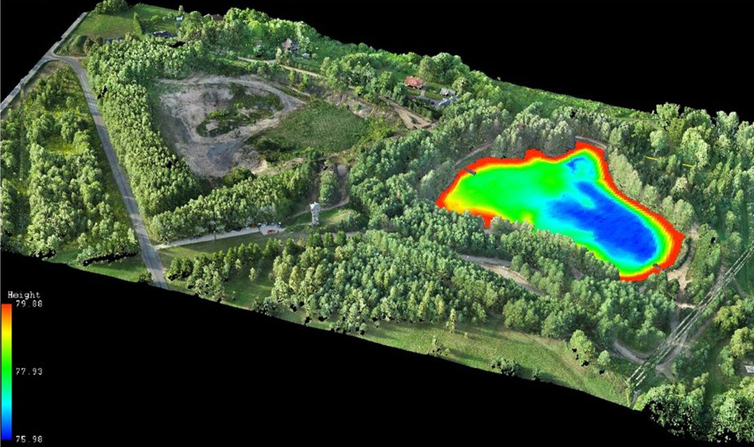
Drones significantly enhance mineral exploration and mining operations by offering faster, more precise, and cost-effective solutions compared to traditional methods. UAV systems, combined with tools like UgCS and True Terrain Following (TTF) kits, enable geologic mapping, ore body identification, and anomaly detection. Drones equipped with sensors like magnetometers, LiDAR, and GPR can perform various tasks, including blast area surveys, stockpile volume quantification, and tramp metal identification, minimizing risks and preventing equipment damage. For recovery, drones monitor water depth, sediments, and vegetation, ensuring environmental compliance. UAVs also facilitate real-time monitoring of mining sites, including humidity analysis and stability assessments. The result is faster data collection, increased accuracy, and significant cost savings, potentially amounting to millions annually by reducing operational expenses and downtime.
Magnetic Surveys
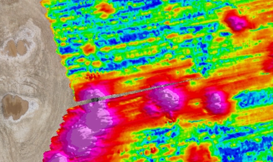
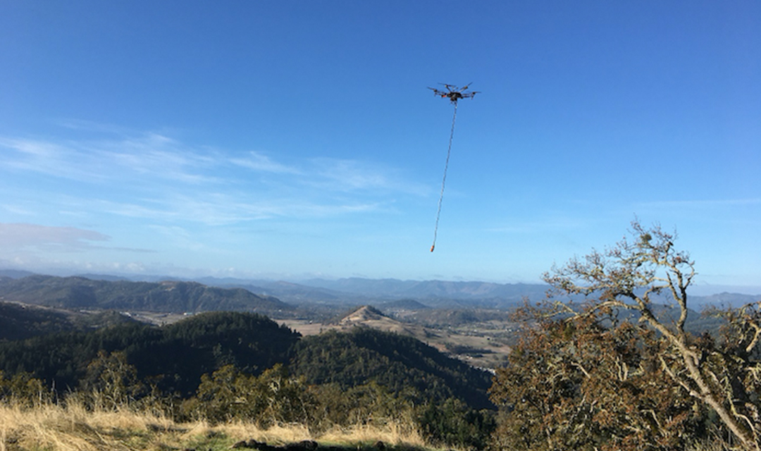
UAVs equipped with magnetometer sensors have revolutionized remote geophysical surveys, making them ideal for mapping mineral deposits, pipelines, and conducting UXO surveys. These UAVs operate at low altitudes, typically between 5-50m AGL for mineral exploration and down to 1m AGL for UXO and underground infrastructure searches, enhancing safety and reducing costs in challenging terrains. Key manufacturers like Geometric, SENSYS, and GEM Systems offer specialized magnetometer payloads, necessitating tailored mission planning. Effective magnetic surveys require careful consideration of factors such as altitude, terrain obstacles, sensor motion, and communication loss protocols. Using mission planning software like UgCS allows for efficient route creation, with options to import KML files or draw routes manually. Setting parameters like flight speed, altitude, and line spacing is crucial for optimal data collection. Additionally, ensuring accurate elevation data through reliable DEM sources is vital for precise UAV operation, especially in remote areas where traditional methods are less effective.
Powerline Inspections
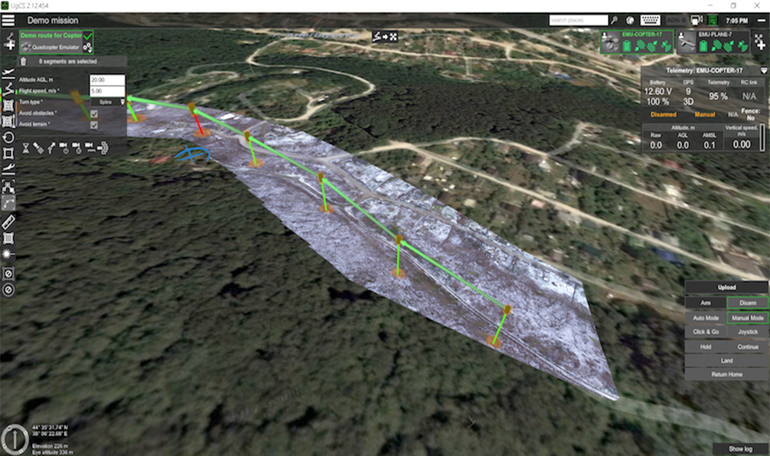
UgCS provides essential tools for powerline inspection using UAVs, significantly saving time and reducing staff exposure to hazards. Key inspection capabilities include detecting concrete basement defects, insulator and wire overheating, wire breaks, tower mechanical defects, corridor inspections for unauthorized objects, wire sag estimation, and corona detection. The inspection process involves importing inspection area coordinates, planning the mission, selecting appropriate drone equipment, deploying ground control points, and executing the flight. Users can choose between fixed-wing and copter drones based on specific inspection needs, utilizing various sensors like EO, IR, UV cameras, and LIDAR for different outputs. Route planning features in UgCS allow for bulk editing of waypoints, circular routes for tower inspections, and control of camera settings for optimal data capture. Ground control points are critical for creating survey-grade results, while image geotagging enhances data processing. UgCS MAPPER offers offline geo-referenced image processing, allowing surveyors to verify image quality in the field. Acquired data can also be imported as map layers for future inspections, ensuring precise mission planning and consistent results.
Live Video Streaming Surveys
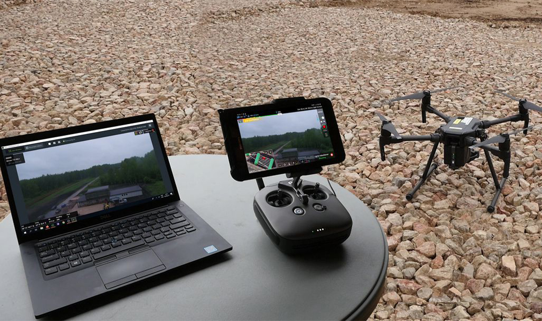
UgCS ENTERPRISE enables low-latency video streaming from drones to any location via WiFi or LTE, adhering to MISB standards for video metadata, including GPS coordinates and camera information. The system supports various drone models, including DJI’s Mavic, Matrice, and Phantom series, as well as Ardupilot/PX4-based drones. A dedicated video observer can monitor the feed while the pilot focuses on flight control, enhancing situational awareness for tasks like industrial inspections and search-and-rescue operations. The setup requires UgCS software on both Android and Windows devices, with automatic connection when on the same network. Video streaming can be integrated with video management systems (VMS) like Milestone and Luxriot, using RTSP links for video feeds. The system also functions within a VPN for added security and complies with MISB standards, supporting metadata streaming alongside video. This robust setup is crucial for applications requiring real-time video surveillance and analysis, ensuring seamless communication between field operators and monitoring teams.
Test Counter-Drone Systems
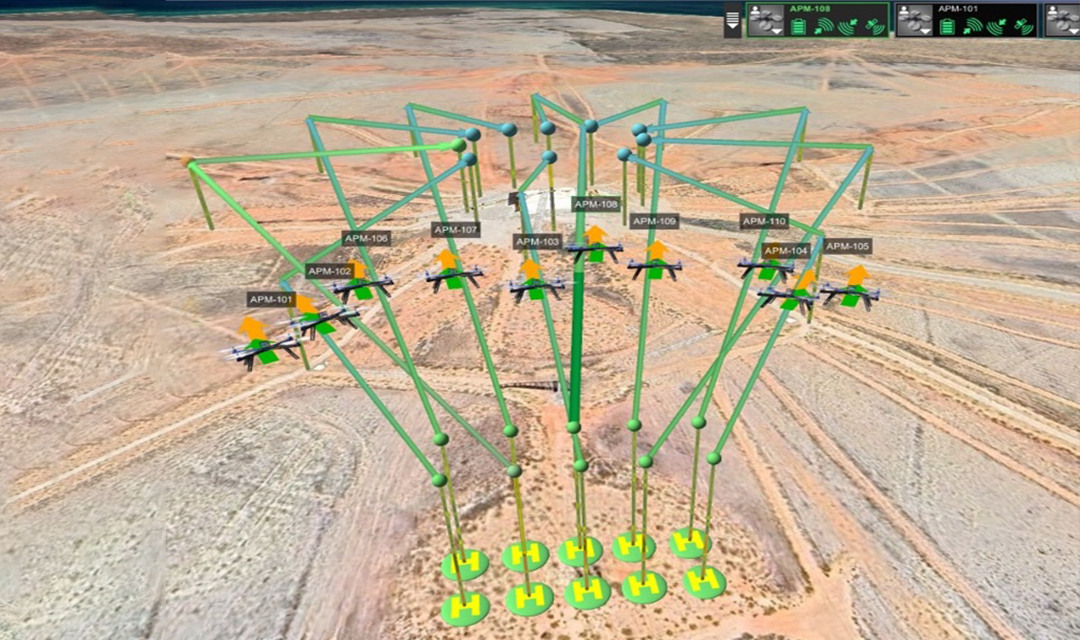
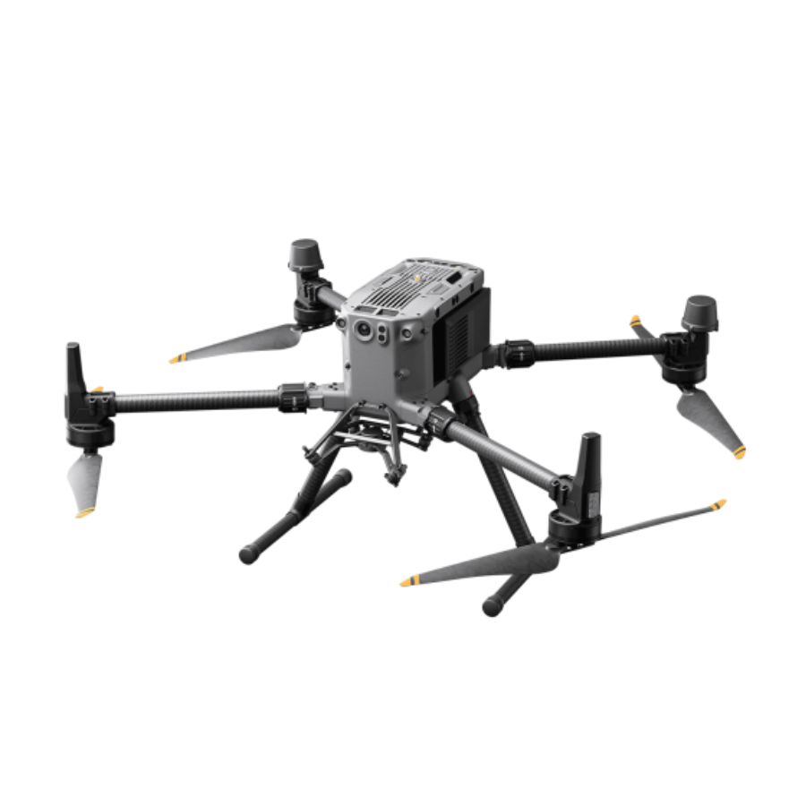
UgCS Commander is designed to enhance operational efficiency for multi-drone operations, supporting popular DJI models like Phantom 4 and M300/350RTK, as well as American-made PX4/Ardupilot drones from brands like Inspired Flight and Freefly. The platform allows users to simultaneously control multiple drones, streamlining operations through coordinated flights. Key features include a real-time telemetry dashboard for monitoring critical data like battery levels, altitude, and speed, and a 3D environment for visualizing drone activities. Users can easily plan routes, assign them to drones, and connect via standard methods like Wi-Fi or radio datalinks. Proximity alerts help maintain safe distances between drones, while control flexibility allows for pausing, resuming, or landing missions as needed. Request a demo to explore the benefits of UgCS Commander and take full control of your drone fleet.















There are no reviews yet.