


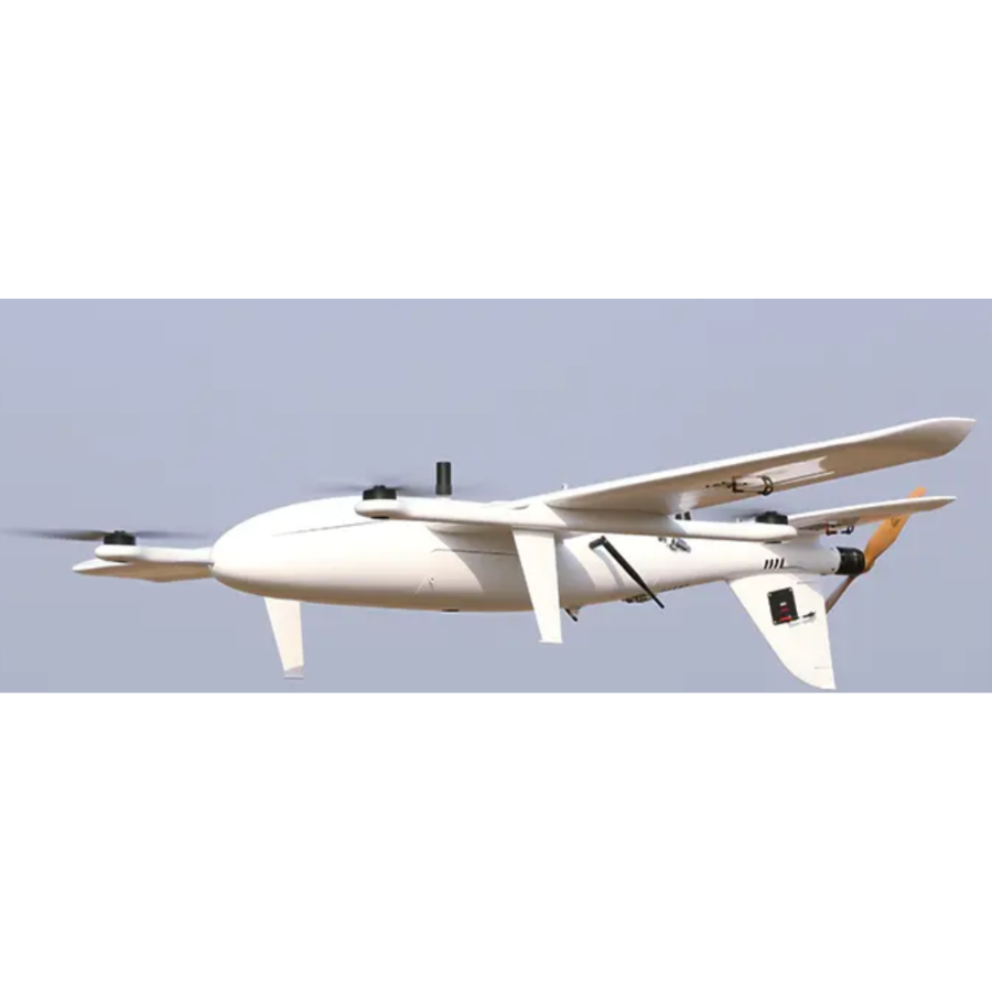
Description
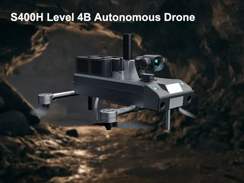
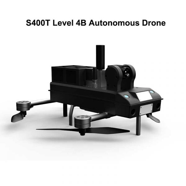
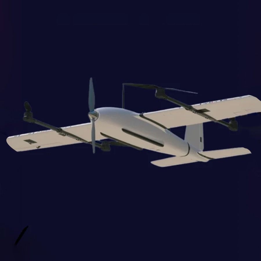
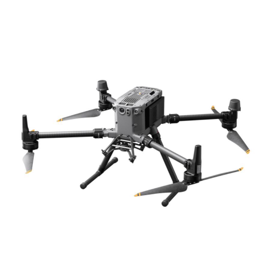
S400 Level 4B Autonomous Inspection Drone
The state-of-the-art industrial UAV designed to meet the growing demands of precision inspection, security surveillance, and autonomous operations. It is equipped with cutting-edge AI technology, a high-performance camera system, LiDAR-based obstacle detection, and long-endurance flight capabilities, making it an ideal choice for complex aerial missions.
Built for both commercial and government applications, the S400 stands out due to its advanced AI-powered autonomy, enabling fully automated flight paths, real-time object recognition, and intelligent navigation. With its RTK GPS integration, the drone achieves centimeter-level positioning accuracy, allowing it to conduct inspections with unmatched precision.
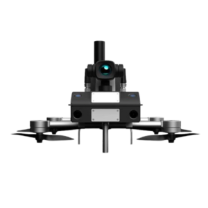
One of the most remarkable features of the S400 is its 40x optical zoom camera, which provides detailed imaging from great distances. Whether inspecting power lines, oil pipelines, telecommunications towers, or large infrastructure, this drone ensures clear visuals with high-definition imaging. Additionally, the thermal and infrared capabilities allow for night-time operations, enhancing its versatility for security and search-and-rescue missions.
LiDAR sensor
The drone’s LiDAR sensor enables it to map environments in 3D and avoid obstacles effectively, ensuring safe operations even in urban or rugged terrains. Its weather-resistant IP65-rated body allows it to function in rain, dust, and other harsh conditions, making it a reliable tool for outdoor missions.
Time Limit
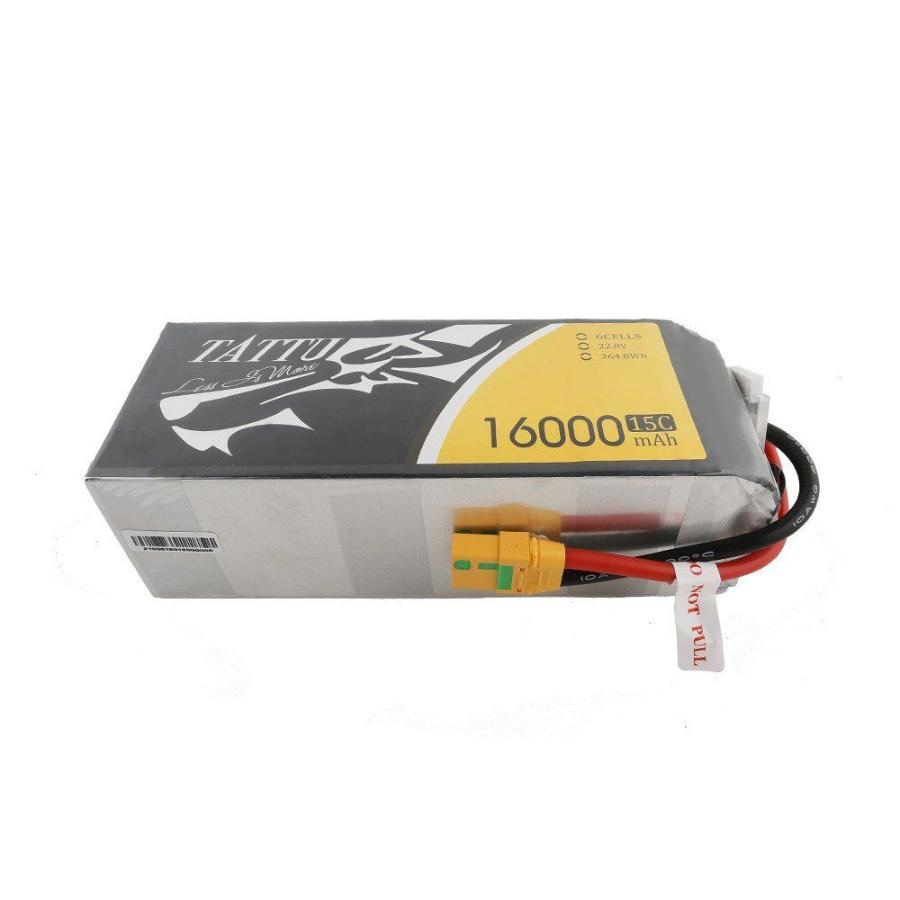
With a maximum flight endurance of up to 90 minutes and an operating range of up to 15 km, the S400 is designed for long-duration tasks, reducing the need for frequent landings and battery swaps. The high-capacity LiPo battery system supports extended operations, ensuring uninterrupted workflows in industrial and critical applications.
Security is another key focus of the S400, featuring AES-256 encrypted communication, which safeguards data transmission and prevents unauthorized access. It also offers multi-platform compatibility, allowing seamless integration with ground control stations and cloud-based software for live monitoring and data analysis.
Designed for professionals
The S400 Level 4B Autonomous Inspection Drone is the ultimate solution for industries requiring high-precision aerial surveillance, infrastructure monitoring, environmental mapping, and security enforcement. Its intelligent automation, superior imaging, and rugged design make it an indispensable tool for the modern era of unmanned aerial operations.
Features
Feature |
Description |
|---|---|
| Autonomous Operation | Fully autonomous AI-powered navigation and obstacle avoidance. |
| 40x Zoom Camera | High-definition camera with 40x optical zoom for detailed inspections. |
| LiDAR Sensor | Advanced LiDAR for high-precision 3D mapping and obstacle detection. |
| Long Flight Endurance | Capable of extended flight times for long-range missions. |
| Weather Resistance | Designed for reliable performance in harsh weather conditions. |
| RTK Positioning | Real-time kinematic GPS for centimeter-level accuracy. |
| High Payload Capacity | Supports multiple sensors and cameras for diverse applications. |
| Multi-Platform Compatibility | Works with various control systems and cloud-based monitoring software. |
| Night Vision & Thermal Imaging | Equipped with infrared and thermal cameras for night operations. |
| Encrypted Communication | Secure data transmission with AES-256 encryption. |
S400 Level 4B Autonomous Inspection Drone
1. Advanced Autonomy
-
Fully autonomous operation with Level 4B AI capabilities
-
Requires minimal human intervention
-
Intelligent navigation and obstacle avoidance
2. High-Precision Inspection
-
Equipped with high-resolution cameras and LiDAR sensors
-
Real-time data collection and analysis
-
Thermal imaging for defect detection
3. Robust Build & Design
-
Weather-resistant for all-terrain operations
-
Lightweight yet durable frame
-
Modular design for easy maintenance
4. AI-Powered Data Processing
-
Onboard AI for real-time decision-making
-
Cloud connectivity for remote monitoring
-
Predictive analytics for maintenance and anomaly detection
5. Extended Flight & Range
-
Long battery life with efficient power management
-
Capable of covering large areas in a single flight
-
Smart return-to-home and self-charging features
S400 Level 4B Autonomous Inspection Drone
The state-of-the-art industrial UAV designed for autonomous aerial inspections, surveillance, and long-range monitoring. Engineered with cutting-edge AI technology, the drone offers fully autonomous operation, real-time obstacle avoidance, and high-precision mapping capabilities.
Equipped with a 40x optical zoom HD camera, the S400 delivers exceptional image clarity, making it ideal for infrastructure inspections, security surveillance, and environmental monitoring. The drone also features a thermal and infrared camera, enabling night vision and heat signature detection for search-and-rescue missions and industrial applications.
A LiDAR-based obstacle detection system ensures safe navigation in complex environments The S400 Level 4B Autonomous Inspection Drone is a powerful solution for professionals in infrastructure inspection, security, search and rescue, environmental monitoring, and industrial asset management. With its advanced AI-driven automation, high-performance imaging, and rugged durability, it is a top-tier choice for demanding aerial operations.
The S400 Level 4B Autonomous Inspection Drone is a cutting-edge UAV designed for industrial and security applications. It features an advanced AI-driven autonomous system, 40x zoom camera, LiDAR, and long-endurance capabilities, making it ideal for inspections, monitoring, and surveillance tasks. The S400 is equipped with a lightweight yet robust frame, allowing seamless navigation in complex environments.
1. Category: Autonomous Industrial Inspection Drone
The S400 Level 4B is a state-of-the-art autonomous industrial inspection drone designed for high-precision monitoring, surveying, and inspection tasks. It falls under the commercial and industrial UAV (Unmanned Aerial Vehicle) category, specifically built for infrastructure maintenance, environmental monitoring, and industrial safety assessments.
2. Category: Advanced AI & Autonomy
This drone is equipped with Level 4B autonomy, meaning it can perform complex inspection missions without human intervention. Its AI-powered navigation system enables intelligent path planning, real-time obstacle avoidance, and automated data analysis, making it highly efficient for large-scale operations.
3. Category: High-Precision Sensing & Imaging
The S400 Level 4B integrates a suite of advanced sensors, including:
-
High-resolution optical cameras for detailed visual inspections
-
Thermal imaging cameras for detecting temperature anomalies in power grids, pipelines, and industrial machinery
-
LiDAR sensors for accurate 3D mapping and structural assessment
These technologies allow for precise defect detection, minimizing risks in critical infrastructure.
4. Category: Long-Range & High-Endurance UAV
Designed for extended missions, this drone features a high-capacity lithium-polymer (LiPo) battery, enabling long flight durations and covering vast areas in a single deployment. Smart power management and swappable battery systems further enhance its efficiency for remote and large-scale inspections.
5. Category: Secure & Connected System
With 5G, RF, and encrypted cloud connectivity, the drone ensures real-time data transmission to ground control stations. Secure data encryption protects sensitive information, making it ideal for industries such as energy, telecommunications, and security surveillance.
6. Category: Modular & Customizable Platform
The S400 Level 4B features a modular payload system, allowing users to customize the drone with additional sensors, tools, and attachments. This adaptability makes it suitable for construction site monitoring, disaster response, and environmental surveying.
7. Category: Compliance & Safety-Driven UAV
Built with redundant flight control systems, emergency landing protocols, and a parachute deployment system, the drone prioritizes safety. It complies with global aviation and UAV safety regulations, ensuring safe and reliable operations in various environments.
Biomimetic Vision Technology
Utilizing biomimetic vision technology, relying on powerful edge computing capabilities, S400 drone can realize real-time perception and 3D map construction of the surrounding environment, and complete path planning and intelligent decision-
making based on the spatial information of obstacles in the surrounding environment.
Level 4 Autonomous Flying
In 90% of complex scenarios, pilot control is not required, featuring fully autonomous intelligent flight with spatial environment awareness, obstacle recognition, and real-time path planning. S400 can operate in more complex and unpredictable environments, such as urban landscapes or disaster zones, where human pilots might struggle to navigate.
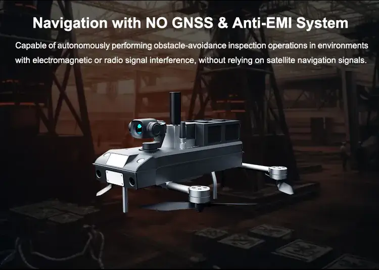
Navigation with NO GNSS & Anti-EMI System & 3D Reconstruction and Display
Equipped with high-resolution cameras and specialized sensors that can quickly and safely provide highly accurate and detailed 3D mapping of underground terrains with no GNSS; can inspect 220 Kilowatt high voltage transformers in for signs of damage, corrosion, or other issues that could affect their performance or safety.
The S400 Level 4B Autonomous Inspection Drone is a high-performance industrial UAV designed for long-range autonomous inspections, surveillance, and mapping applications. It is equipped with AI-driven navigation, a 40x zoom camera, LiDAR, thermal imaging, and RTK GPS for centimeter-level accuracy.
Industrial Inspections
Power Line & Tower Inspection – Identifies faults, damages, and wear.
Oil & Gas Pipeline Monitoring – Detects leaks and corrosion.
Bridge & Infrastructure Inspection – Provides detailed imaging for maintenance planning.
Security & Surveillance
Border & Perimeter Security – AI-powered patrols for threat detection.
Disaster Response & Search-and-Rescue – Thermal imaging locates missing persons.
Traffic & Crowd Monitoring – Assists law enforcement with aerial surveillance.
Mapping & Surveying
3D Terrain Mapping – LiDAR scans create accurate models.
Forestry & Agriculture Monitoring – Detects plant health and soil conditions.
Environmental Studies – Monitors wildlife, coastal erosion, and pollution.
S400 is an autonomous drone powered by AI for exceptional data capture. Even under extreme conditions with no satellite signals and strong electromagnetic interference, it is capable of high-precision navigation, real-time path planning, and autonomous obstacle-avoidance flight, demonstrating its exceptional environmental adaptability and intelligent flight performance.
The S400 autonomous drone comes in two versions
S400H Version, equipped with an 8MP high-definition CMOS sensor, offering outstanding image data acquisition capability
S400T Version, equipped with a high-resolution thermal imaging camera of 640×512, capable of measuring temperatures in the range of -20°C to 150°C.
Component |
Description & Function |
|---|---|
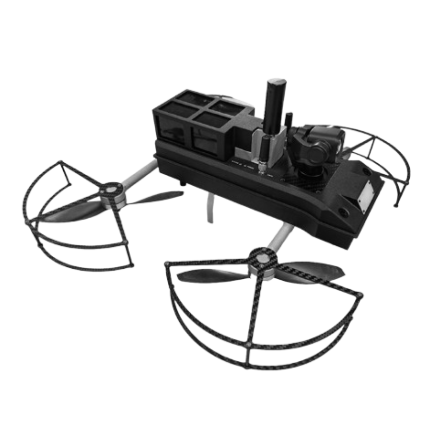
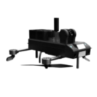
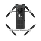
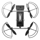
| Airframe & Structure | Made of carbon fiber and aerospace-grade aluminum, ensuring durability and lightweight performance. Designed for aerodynamics, reducing wind resistance. |
| Propulsion System | Features four high-efficiency brushless motors with foldable carbon-fiber propellers for stable flight and reduced noise. |
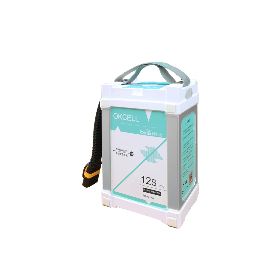
| Battery System | Uses high-capacity LiPo batteries supporting up to 90 minutes of flight time. Swappable battery design for quick replacements. |
| AI Autonomy Module | Built-in AI-powered autonomous flight system for pre-programmed missions, obstacle avoidance, and self-correction in dynamic environments. |
| RTK GPS Unit | Real-Time Kinematic (RTK) GPS ensures centimeter-level accuracy, making it suitable for precision mapping and industrial inspections. |
| Obstacle Avoidance System | Equipped with LiDAR sensors and ultrasonic detectors for real-time obstacle detection and collision prevention. |
| Camera System (Primary) | 40x Optical Zoom HD Camera with real-time stabilization for capturing high-detail images and videos. |
| Camera System (Secondary) | Thermal & Infrared Camera for night vision and heat signature detection. Ideal for security, search and rescue, and industrial safety monitoring. |
| Gimbal System | 3-axis stabilized gimbal ensuring smooth video recording and sharp image capture, even in windy conditions. |
| Communication System | Features AES-256 encrypted transmission, 15 km operational range, and multi-frequency anti-jamming technology. |
| Landing Gear | Retractable landing gear for smooth landings and compact storage. |
| Control & Monitoring System | Smart Ground Control Station (GCS) with a touchscreen interface, real-time telemetry, and mission planning software. |
| Payload Bay | Customizable payload bay allows additional modules like LiDAR, extra cameras, or gas detection sensors. |
| Weatherproofing | IP65-rated body, making it resistant to rain, dust, and extreme environmental conditions. |
| Data Storage & Processing | Supports onboard SD card storage and cloud-based data transmission for live monitoring. |
Key Components
1. Airframe & Structure
-
Made of lightweight carbon fiber and aerospace-grade aluminum
-
Weather-resistant for operation in harsh environments
-
Aerodynamically designed for stability and efficiency
2. Propulsion System
-
High-efficiency brushless motors for smooth flight
-
Multi-rotor configuration for stability and maneuverability
-
Advanced electronic speed controllers (ESC) for precise control
3. Sensor Suite
-
LiDAR Sensor: Provides 3D mapping and obstacle detection
-
High-Resolution Camera: Captures detailed visual data for inspection
-
Thermal Imaging Camera: Detects heat variations for defect identification
-
Ultrasonic Sensors: Enhances collision avoidance capabilities
4. Flight Control & Autonomy System
-
AI-driven autopilot for autonomous navigation
-
GPS and GNSS modules for accurate positioning
-
Redundant IMU (Inertial Measurement Unit) for precise movement tracking
-
Real-time obstacle avoidance and path planning algorithms
5. Communication & Connectivity
-
Secure 5G and RF communication for long-range operations
-
Real-time data transmission to ground stations
-
Encrypted cloud connectivity for remote monitoring and analysis
6. Power & Battery System
-
High-capacity lithium-polymer (LiPo) battery pack
-
Smart battery management system for extended flight time
-
Swappable battery design for quick replacement
7. Payload & Modular Attachments
-
Interchangeable payload system for various inspection needs
-
Customizable mounts for additional sensors and tools
-
Precision payload gimbal for stable imaging
8. Safety & Redundancy Systems
-
Automatic emergency landing in case of failure
-
Parachute deployment system for added safety
-
Redundant flight control units for reliability
Specifications
Specification |
Details |
|---|---|
| Flight Time | Up to 90 minutes (depending on payload) |
| Max Flight Speed | 20 m/s |
| Operating Range | Up to 15 km |
| Weight | 19 kg |
| Camera Zoom | 40x optical zoom |
| Battery Type | High-capacity LiPo battery |
| Payload Capacity | 3 kg |
| Navigation System | RTK GPS, AI-powered autonomy |
| Weather Resistance | IP65-rated waterproof design |
| Obstacle Avoidance | LiDAR-based multi-directional sensing |
Includes
-
1x S400 Autonomous Drone
-
1x 40x Zoom Camera Module
-
1x LiDAR Sensor
-
2x High-Capacity Batteries
-
1x Smart Ground Control Station
-
1x Carrying Case
-
1x Charger & Cables
-
1x User Manual
FAQS
Q1: What is the flight time of the S400 drone?
A: The S400 can fly for up to 90 minutes, depending on payload and weather conditions.
Q2: Does it support autonomous flight?
A: Yes, the S400 is equipped with AI-powered autonomy and RTK GPS for precise navigation.
Q3: Can it be used in harsh weather conditions?
A: Yes, the drone is IP65-rated, making it resistant to dust and water.
Q4: What type of camera does it have?
A: It features a 40x zoom camera for detailed inspections and thermal imaging for night operations.
Q5: What is the max operating range?
A: The S400 can operate up to 15 km from the control station.
Q6: Is it compatible with third-party software?
A: Yes, the drone supports multi-platform compatibility and integrates with cloud-based monitoring tools.


There are no reviews yet.