Description
Multispectral And RGB Sensor
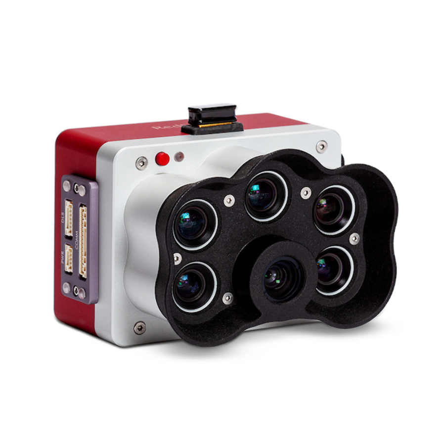
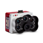
The RedEdge-P Multispectral and RGB Sensor is a cutting-edge, compact imaging solution designed for professional use in agriculture, environmental monitoring, and geographic mapping. This advanced sensor captures high-resolution images across five specific spectral bands (blue, green, red, red edge, and near-infrared), alongside a high-quality RGB camera for standard color photographs. Ideal for precision agriculture, the RedEdge-P enables detailed analysis of crop health, stress detection, and yield optimization, offering actionable insights to improve farming practices. Its capabilities extend to environmental monitoring, aiding in the assessment of ecosystem changes, vegetation health, and water quality. Engineered for easy integration with a variety of unmanned aerial vehicles (UAVs), its compact and lightweight design ensures minimal impact on flight dynamics. The sensor is built to endure the challenges of field and aerial operations, featuring a user-friendly interface for straightforward operation and data collection. The RedEdge-P stands as a versatile tool for professionals seeking to leverage remote sensing for detailed analysis and informed decision-making.
High-Resolution Multispectral Imaging: The RedEdge-P is equipped with advanced sensors that capture images in five distinct spectral bands: blue, green, red, red edge, and near-infrared. This feature is crucial for analyzing plant health, moisture levels, and other critical agricultural metrics.
Integrated RGB Camera: Alongside its multispectral capabilities, the RedEdge-P features a high-quality RGB camera. This allows users to take standard color photographs, making it easier to visualize the area of interest in natural colors and compare it with multispectral data.
Precision Agriculture Applications: Designed with precision farming in mind, the sensor helps in monitoring crop health, detecting plant stress early, and optimizing yield. It enables farmers to make informed decisions, ultimately leading to more sustainable agricultural practices.
Environmental Monitoring: The sensor is also a powerful tool for environmental monitoring, capable of assessing changes in ecosystems, tracking vegetation health, and analyzing water quality. It supports efforts in conservation and land management effectiveness.
Advanced Data Processing: Compatible with sophisticated analytical software, the RedEdge-P facilitates the conversion of raw images into actionable insights. This data can then be used for detailed analysis and decision-making processes.
Compact and Lightweight Design: Its design ensures that it can be easily integrated with various drones, minimizing the impact on flight performance. This makes it an ideal tool for aerial surveys and remote sensing applications.
High Accuracy: The sensor is calibrated for accurate data collection under different lighting conditions and environments. This ensures consistency in data quality, which is critical for time-series analysis and comparative studies.
Easy Integration: The RedEdge-P offers flexible mounting options and is compatible with a wide range of unmanned aerial vehicles (UAVs). Its ease of integration makes it a valuable addition to any drone-based remote sensing operation.
Durable Construction: Built to endure outdoor and aerial use, the sensor is reliable and long-lasting. It is designed to withstand the rigors of field operations, ensuring that it remains a dependable tool for professionals.
User-Friendly Interface: Featuring an intuitive user interface, the RedEdge-P is accessible to both beginners and professionals. It simplifies operation, data capture, and configuration, reducing the learning curve and enabling efficient use in the field.
Versatile Use Cases: Beyond agriculture and environmental monitoring, the sensor is suitable for various applications, including forestry management, urban planning, and geological surveys. Its versatility makes it an invaluable asset across multiple disciplines.
Data Compatibility: The captured data is compatible with numerous GIS and remote sensing software platforms, facilitating seamless integration into existing workflows and enabling comprehensive spatial analysis.
Educational Value: The RedEdge-P serves as an excellent educational tool, providing students and researchers with hands-on experience in remote sensing and environmental analysis, enriching learning and research opportunities.
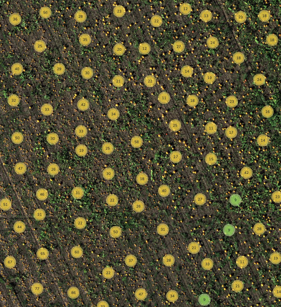
Counting Plants
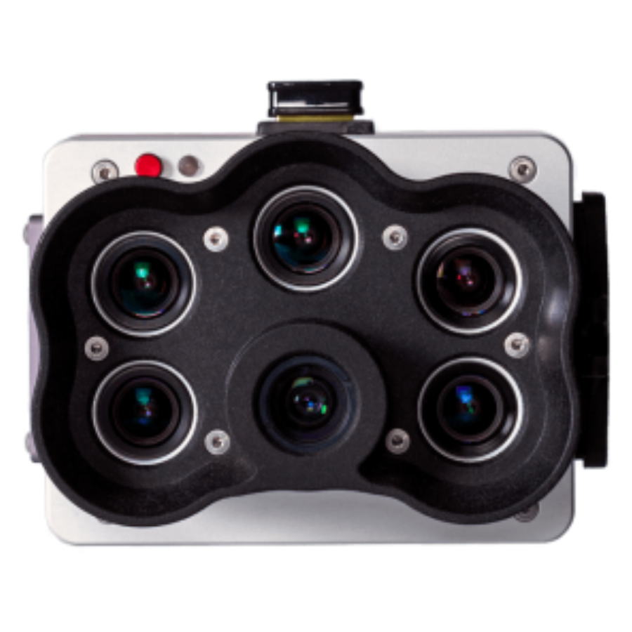
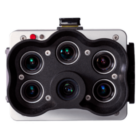
Algorithms for counting plants need high-resolution photography. RedEdge-P produces high-resolution RGB and multispectral outputs, allowing for plant counting even in the early stages of growth, by combining a panchromatic lens with five high-resolution multispectral lenses.
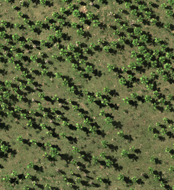
High Resolution Panchromatic Sensor
RedEdge-P, when flying at 60 m / 200 ft, provides higher-resolution RGB and multispectral outputs with a resolution of 2 cm per pixel / 0.78 in per pixel thanks to a high-resolution panchromatic imager. You can identify minor issues or characteristics earlier and make more trustworthy management judgments in a range of application cases when the imagery is crisper.
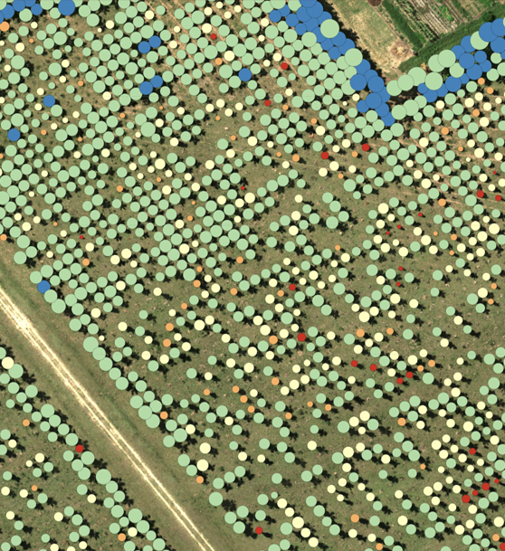
Strong AI Capabilities
RedEdge-P provides high-resolution RGB and multispectral imaging for machine learning applications, including improved vegetation research applications and plant counts, because of the panchromatic band.
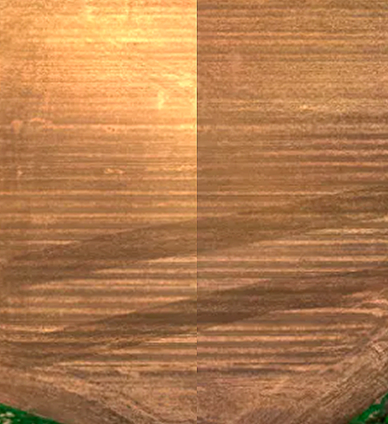
Multispectral Imagery Calibration
A Reflectance Panel for on-site calibration and a DLS2 light sensor for measuring sun angle and irradiance are included with every RedEdge-P camera package. By taking into consideration varying weather and lighting conditions, these radiometric calibration techniques produce more precise and trustworthy data that allow for time series analysis and output comparability over time.
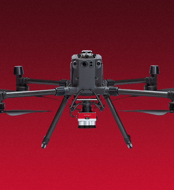
Suitable with a large variety of processing Software and Drones
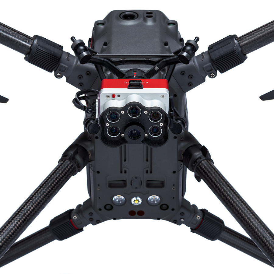
DJI’s M300 RTK drones are perfectly compatible with the RedEdge-P SkyPort. Moreover, the camera has an open API interface that makes it simple to integrate with a wide range of widely used software and drone platforms.
Specifications
Weight
363 g (12.8 oz.) (RedEdge-P + WI-Fi + CF Express Card + DLS2 & Cables)
Dimensions
8.9 x 7.0 x 6.7 cm (3.5in x 2.8in x 2.6in)
External Power
7.0 V - 25.2 V
Power Input
5.5/7.0/10W (standby, average, peak)
Sensor Resolution
1456 x 1088 (1.6MP per MS band) 2464 x 2056 (5.1MP panchromatic band)
Spectral Bands
Blue, green, red, red edge, near-IR (global shutter, narrowband)
Wavelength (nm)
Blue (475 nm center, 32 nm bandwidth), green (560 nm center, 27 nm bandwidth), red (668 nm center, 14 nm bandwidth), red edge (717 nm center, 12 nm bandwidth), near-IR (842 nm center, 57 nm bandwidth)
RGB Color Output
5.1 MP (global shutter, aligned with all bands) *with appropriate post-processing
Ground Sample Distance (GSD)
7.7 cm per pixel (per MS band) at 120m (~400 ft) AGL 3.98 cm per pixel (panchromatic band) at 120m (~400 ft) AGL
Capture Rate
Up to 3 captures per second raw DNG
Interfaces
3 configurable GPIO: select from trigger input, PPS input, PPS output, and top of frame signals. Host virtual button. USB 2.0 port for WiFi. Serial. 10/100/1000 Ethernet. CF Express for storage
Field of View
50° HFOV x 38° VFOV (MS) 44° HFOV x 38° VFOV (PAN)
Storage
CFexpress Card
FAQs for RedEdge-P Multispectral And RGB Sensor
- What spectral bands does the RedEdge-P capture?
- The RedEdge-P captures images in five specific spectral bands: blue, green, red, red edge, and near-infrared, in addition to high-resolution RGB images.
- Can the RedEdge-P sensor be used for crop health monitoring?
- Yes, it is specifically designed for precision agriculture applications, including crop health monitoring, stress detection, and yield optimization, by analyzing data from its multispectral bands.
- Is the RedEdge-P compatible with all types of drones?
- While it is designed to be compact and lightweight for easy integration, compatibility may vary depending on the drone’s model and payload capacity. It’s best to check compatibility with your specific drone model.
- How does the RedEdge-P benefit environmental monitoring?
- The sensor aids in monitoring ecosystem changes, vegetation health, and water quality, providing valuable data for environmental conservation and land management practices.
- What software is needed to process images captured by the RedEdge-P?
- Images from the RedEdge-P can be processed with a variety of advanced analytical and GIS software platforms that support multispectral data analysis.
- Can the RedEdge-P sensor capture images under different lighting conditions?
- Yes, it is calibrated to ensure accurate data collection under a range of lighting conditions, providing consistent and reliable imagery.
- What is the resolution of the RGB camera on the RedEdge-P?
- For specific details about the RGB camera’s resolution, please refer to the product specifications, as it’s designed to capture high-quality color photographs alongside multispectral data.
- How do I mount the RedEdge-P sensor to my drone?
- The RedEdge-P comes with mounting options for easy attachment to compatible drones. Detailed instructions are provided with the sensor for secure and optimal mounting.
- Is the RedEdge-P sensor durable for field use?
- Yes, it’s built with durable materials to withstand the rigors of outdoor and aerial use in various environmental conditions, ensuring longevity and reliability.
- Where can I get technical support for the RedEdge-P?
- Technical support for the RedEdge-P is available through the manufacturer’s customer service channels. They provide assistance with setup, operation, and troubleshooting to ensure optimal use of the sensor.

















There are no reviews yet.