Altimeter

  • Precise Altitude Measurement
  • Real-Time Data Output
  • Barometric Sensor Technology
  • Versatile Applications
  • Compact and Lightweight
  • User-Friendly Interface
  • High Accuracy & Energy Efficiency

1-Year Warranty     7 days return policy     PAN India Fast Shipping   

Description

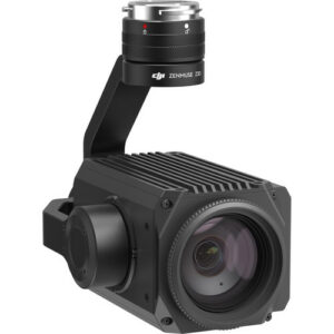
Altimeter – Accurate Altitude Measurement for Precision Navigation

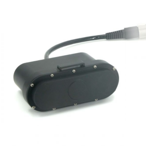
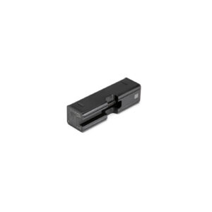
The Altimeter is a crucial instrument designed to measure altitude with precision, whether above sea level or ground level. Utilizing advanced barometric sensor technology, it provides real-time altitude data essential for navigation, flight planning, and terrain analysis in various environments.

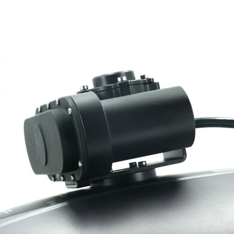
Ideal for drones, aircraft, and outdoor enthusiasts engaged in activities such as hiking and climbing, the Altimeter offers versatility and reliability. Its compact and lightweight design ensures easy integration into different devices without compromising mobility or adding unnecessary weight.

With a user-friendly interface, the Altimeter facilitates straightforward setup and operation, making it accessible for users of all experience levels. It delivers high accuracy in altitude measurements, ensuring dependable performance across diverse weather conditions and operational scenarios.

Distance Meter

Built for durability and resilience, the Altimeter is weather-resistant, capable of maintaining optimal functionality in challenging outdoor environments. It operates with minimal power consumption, optimizing battery life for extended use, which is crucial for prolonged aerial or outdoor activities.

Whether you’re navigating through remote landscapes, conducting aerial surveys, or planning precision flights, the Altimeter enhances your capability to monitor altitude effectively, providing essential data for safe and accurate operations.

Distance Meter

Integrated Functionality

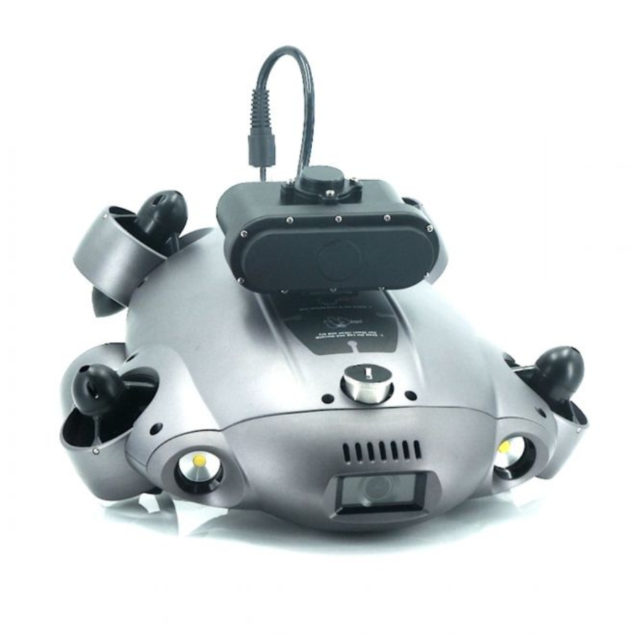
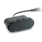
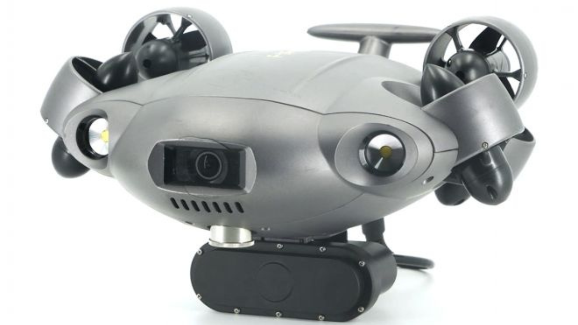
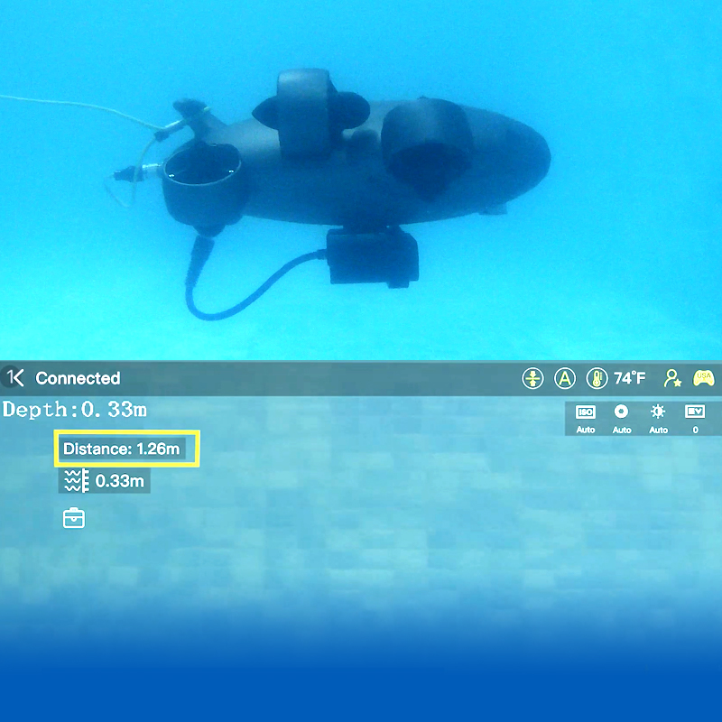
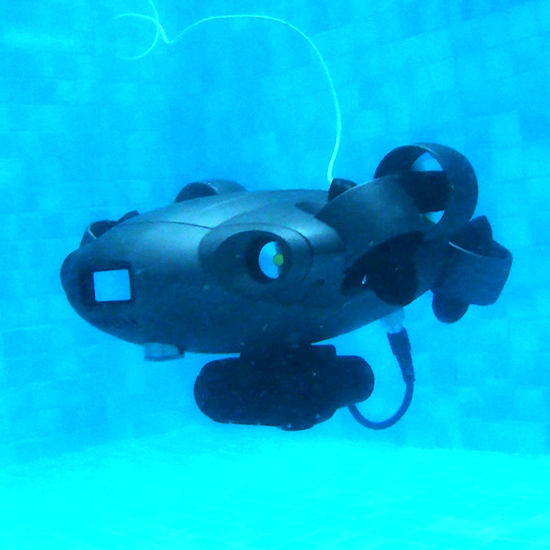
Integrated with the FIFISH APP, the Distance Meter calculates the distance between the ROV and the object in front, displaying the data conveniently on the app interface for easy access.

Distance Meter

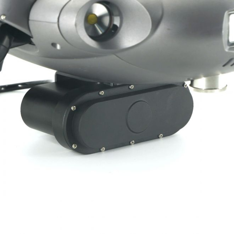
Simple & Easy Assembly

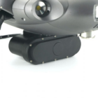
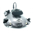
Easily attach the Distance Meter add-on and its power cable to your ROV’s fuselage, and it’s ready for immediate operation and dives. By automating routine underwater measurement tasks, you can significantly reduce operational costs and minimize human risks.

Specifications

General

Depth 100m
Current 200mA
Voltage 5V-15V
Range 0.4m-6m
Operation Temperature -5℃~60℃
Downward Sonar Quantity 1

FAQ's

  1. What is an altimeter and how does it work?
    • An altimeter is a device used to measure altitude above a reference point, typically sea level or ground level. It works using barometric pressure sensors to calculate altitude based on atmospheric pressure changes.
  2. What are the main applications of an altimeter?
    • Altimeters are used in aviation for aircraft altitude measurement, in outdoor activities such as hiking and climbing for elevation tracking, and in drones for precision flight and terrain analysis.
  3. How accurate is an altimeter in measuring altitude?
    • The accuracy of an altimeter depends on factors such as sensor quality and calibration. High-quality altimeters can provide altitude measurements with precision suitable for navigation and flight planning.
  4. Is an altimeter easy to use?
    • Modern altimeters are designed with user-friendly interfaces and straightforward operation, making them accessible for both professionals and enthusiasts alike.
  5. Can an altimeter be used in different weather conditions?
    • Yes, altimeters are built to withstand varying weather conditions and provide reliable altitude measurements regardless of environmental factors like temperature and humidity.
  6. What is the range of altitude measurement for typical altimeters?
    • Altitude measurement ranges vary depending on the model and application, but they generally cover a wide range from below sea level to high altitudes encountered in aviation.
  7. How does an altimeter help in navigation and flight planning?
    • An altimeter provides crucial altitude data that aids pilots and drone operators in maintaining safe flight levels, avoiding obstacles, and complying with airspace regulations.
  8. Can an altimeter be calibrated for accuracy?
    • Yes, altimeters can be calibrated to ensure accuracy, often by adjusting settings or referencing known altitude benchmarks to align with local atmospheric conditions.
  9. What kind of power source does an altimeter require?
    • Most altimeters are designed to operate on battery power, typically with long battery life to support extended outdoor or aerial activities.
  10. Is an altimeter compatible with different devices and systems?
    • Yes, altimeters are compatible with a wide range of devices including drones, aircraft, handheld GPS units, and mobile apps, offering versatility in integration for various applications.

There are no reviews yet.

Be the first to review “Altimeter”

Your email address will not be published. Required fields are marked *