Management of Water:
Drones are rapidly transforming water management across agriculture, forestry, and environmental science. One key application is monitoring water resources. Specifically, drones equipped with sensors measure water levels in reservoirs, track flow in rivers and streams, and assess water quality in lakes. This data actively helps managers make informed decisions and quickly identify potential problems.
Additionally, drones inspect irrigation systems regularly. They examine pipelines, canals, and infrastructure closely, detecting issues that could reduce irrigation efficiency. Moreover, drones monitor forests, wetlands, and ecosystems involved in the water cycle. They continuously assess forest health and identify areas vulnerable to drought or water stress. Overall, drones provide a safe, efficient, and cost-effective way to manage water resources, irrigation systems, and natural ecosystems. Consequently, they play an increasingly vital role in modern water management.
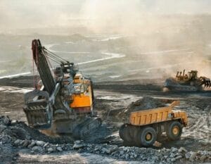
Exploration of Minerals:
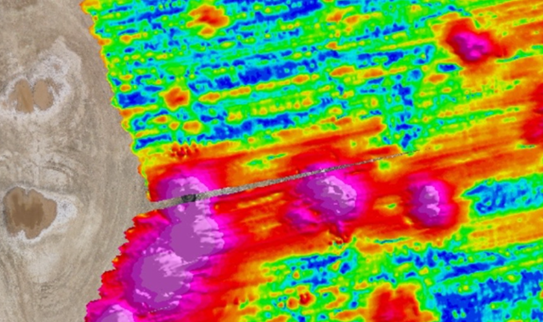
Drones are revolutionizing mineral exploration by enabling efficient and detailed data collection. Equipped with advanced sensors, drones quickly survey vast and challenging terrain. They capture high-resolution images and geospatial data, which help identify mineral deposits accurately.
Moreover, drones use specialized instruments like hyperspectral and thermal sensors to detect mineral signatures. This data enables geologists to analyze soil composition and rock formations without extensive fieldwork.
In addition, drones improve safety by accessing hazardous or remote areas where manual surveys pose risks. They also reduce exploration costs by minimizing the need for large ground teams and heavy machinery.
Overall, drones offer a faster, safer, and more cost-effective solution for mineral exploration. Their precise data gathering supports informed decisions and accelerates resource discovery.
Blast Analysis:
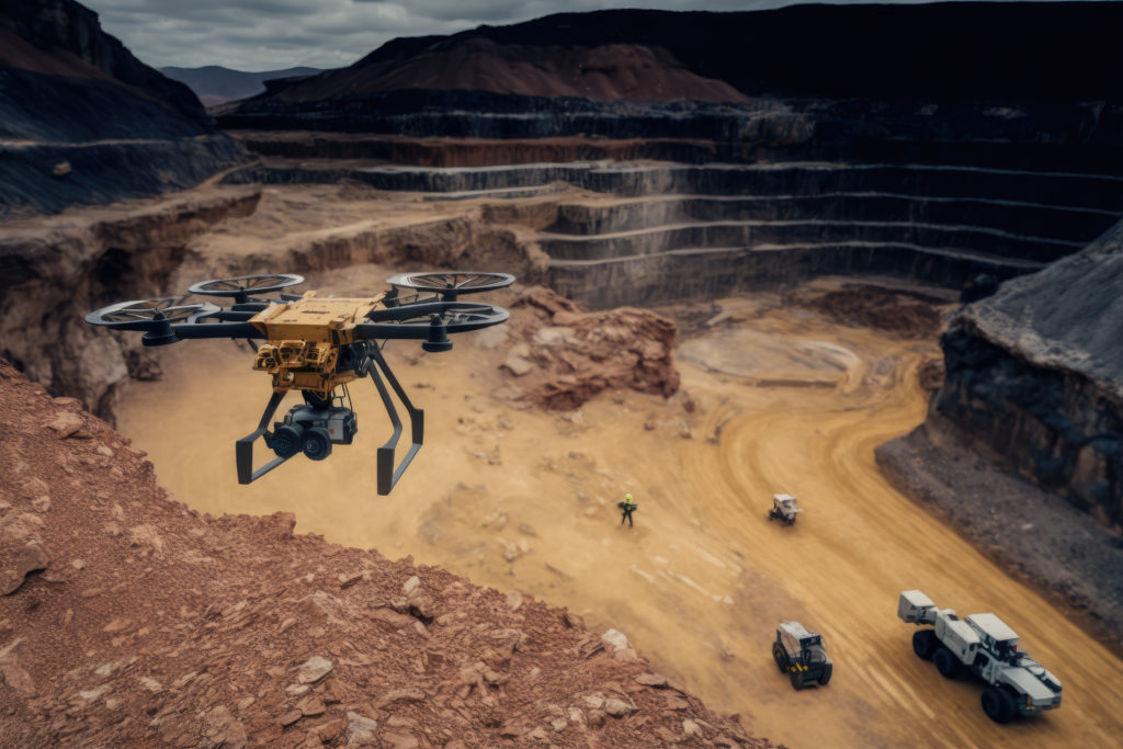
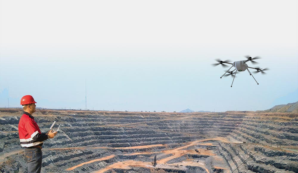
Drones are transforming blast analysis in mining, construction, and other industries using explosives. They capture high-resolution images and data on blast effects. Equipped with cameras and sensors, drones document changes in topography, material displacement, and impacts on structures. Moreover, drones enhance safety by monitoring personnel and equipment movement during blasts. This helps ensure strict adherence to safety protocols. Additionally, drones collect data that optimize blast design. Analyzing this information improves future blast efficiency and effectiveness. Overall, drones provide a safe, efficient, and cost-effective way to capture blast effects, monitor safety, and refine blast strategies. Their role in blast analysis continues to grow rapidly across industries.
Mapping and Surveying:
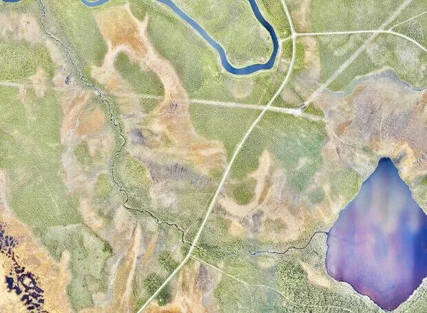
Drones are revolutionizing mapping and surveying across agriculture, construction, and environmental science. They capture high-resolution images and data on terrain, vegetation, and infrastructure using advanced cameras and sensors. This data helps create detailed maps and 3D models of the ground. Furthermore, drones collect important environmental data, including temperature, humidity, air quality, and radiation. This information supports crop management, construction planning, and environmental monitoring. Additionally, drones improve mapping efficiency and accuracy by covering large or hard-to-reach areas quickly. This reduces manual labor and enhances data precision. Overall, drones offer a safe, efficient, and cost-effective solution for capturing images, collecting diverse data, and boosting the accuracy and speed of mapping and surveying tasks. Their role in these fields continues to expand rapidly.
Inspection and monitoring:
Drones are transforming inspection and monitoring across construction, energy, transportation, and manufacturing. They capture high-resolution images and precise data on assets like buildings, pipelines, vehicles, and machinery. This information helps teams plan maintenance and identify problems early. Moreover, drones reduce labor by quickly covering large or hard-to-reach areas. This speeds up inspections while minimizing manual work. Additionally, drones improve accuracy and reliability by using advanced sensors to gather detailed data. This precision supports better decision-making for repairs and upkeep. Overall, drones provide a safe, efficient, and cost-effective solution for inspection and monitoring. Their role continues to grow as they enhance data quality, cut costs, and increase operational efficiency.
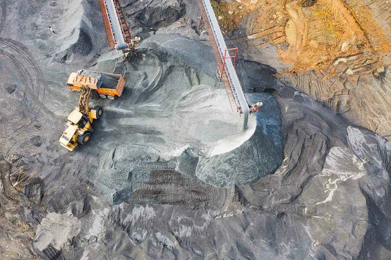
Management of stockpiles:
Drones are transforming stockpile management across mining, construction, and agriculture. They capture high-resolution images and precise data on stockpile volume and condition, such as ore, aggregate, or grain. This data helps improve inventory management and quickly identifies potential issues. Furthermore, drones boost efficiency by covering large or hard-to-reach stockpiles rapidly. This reduces manual labor and speeds up stockpile inspections. Additionally, drones enhance accuracy and reliability. Equipped with advanced sensors, they gather exact measurements that support better inventory decisions. Overall, drones provide a safe, efficient, and cost-effective solution for stockpile management. Their use continues to grow, improving both operational efficiency and data precision.