
Description
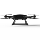
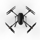
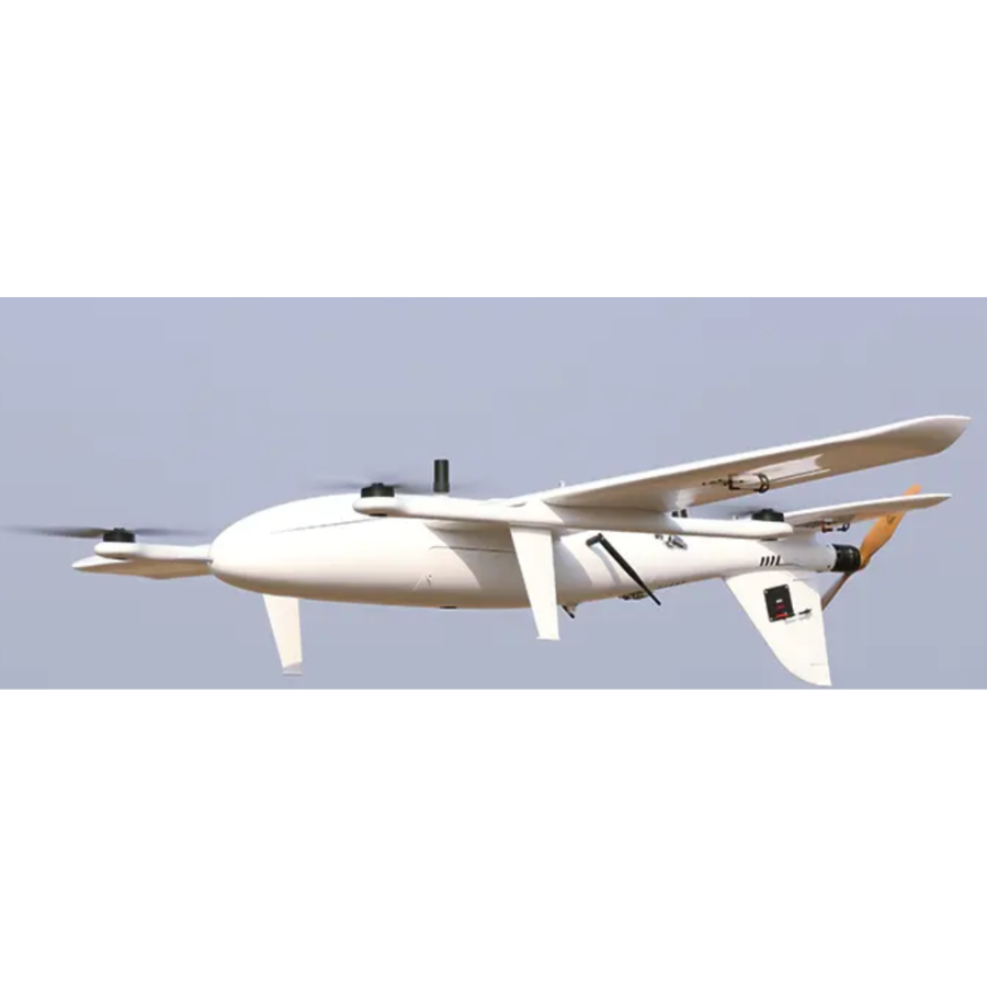
Introducing TAR™️ Tethered Drone System
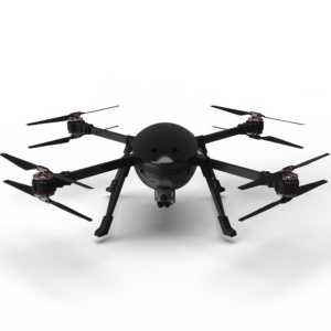
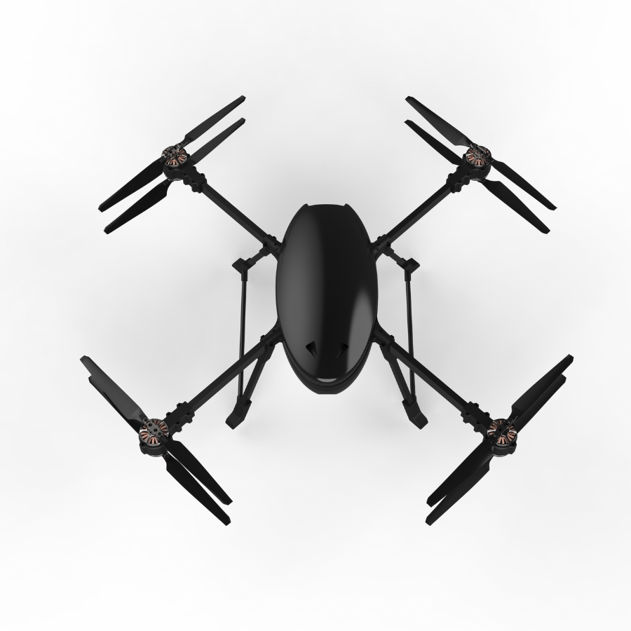
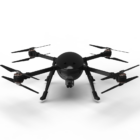
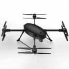
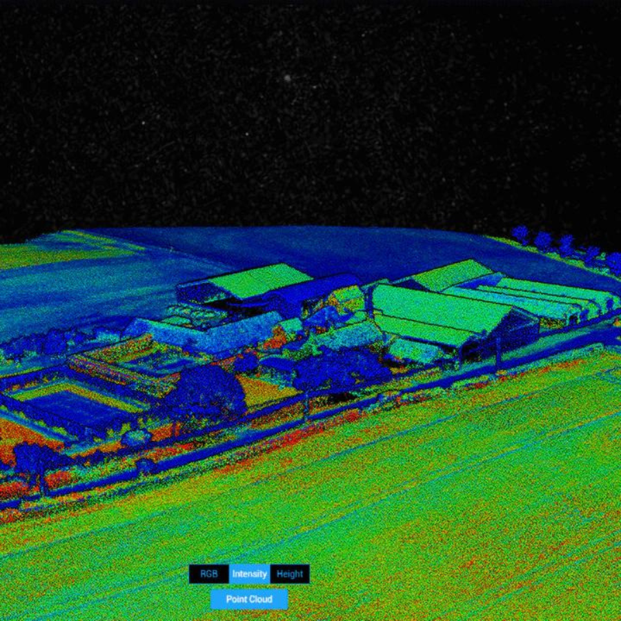
Introducing the TAR™️ (Tethered Aerial Robot) by Karman Drones™️, a groundbreaking solution that redefines aerial surveillance and data collection. With an unparalleled flight time of up to 24 hours, TAR ensures continuous operation without the limitations of traditional drones. Its innovative dual-redundant coaxial design and 100-meter tether provide uninterrupted connectivity, making it ideal for real-time data transmission and versatile payload options. Whether you need to secure critical infrastructure or assist in disaster relief efforts, TAR is engineered for efficiency and reliability. Experience the future of drone technology with TAR, where endurance meets advanced capabilities.
Features
Applications
| Application | Description |
|---|---|
| Law Enforcement and Public Safety | Enhance safety by monitoring high-crime areas, allowing for proactive intervention and improved community security. |
| Search and Rescue | Conduct nighttime search and rescue operations efficiently, ensuring swift response to emergencies. |
| Power Line and Pipeline Monitoring | Identify hotspots, detect leaks, and assess the structural integrity of power lines and pipelines, improving maintenance operations. |
| Wildlife Conservation | Support wildlife conservation efforts by monitoring animal populations, tracking migration patterns, and identifying threats such as poaching. |
| Environmental Monitoring | Aid in forest fire management through infrared capabilities, enabling early detection of fires by identifying temperature anomalies and smoke even in low visibility conditions. |
| Disaster Response | Provide comprehensive assessments of areas affected by natural disasters, assisting emergency responders in effective planning and resource allocation. |
| Critical Infrastructure Protection | Monitor essential facilities such as airports, power plants, and government buildings to ensure their security and integrity. |
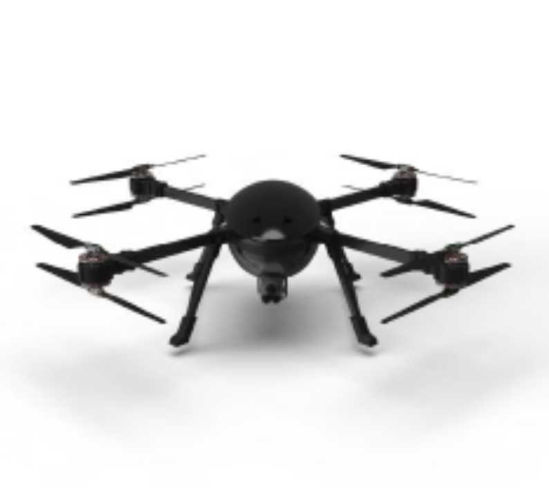
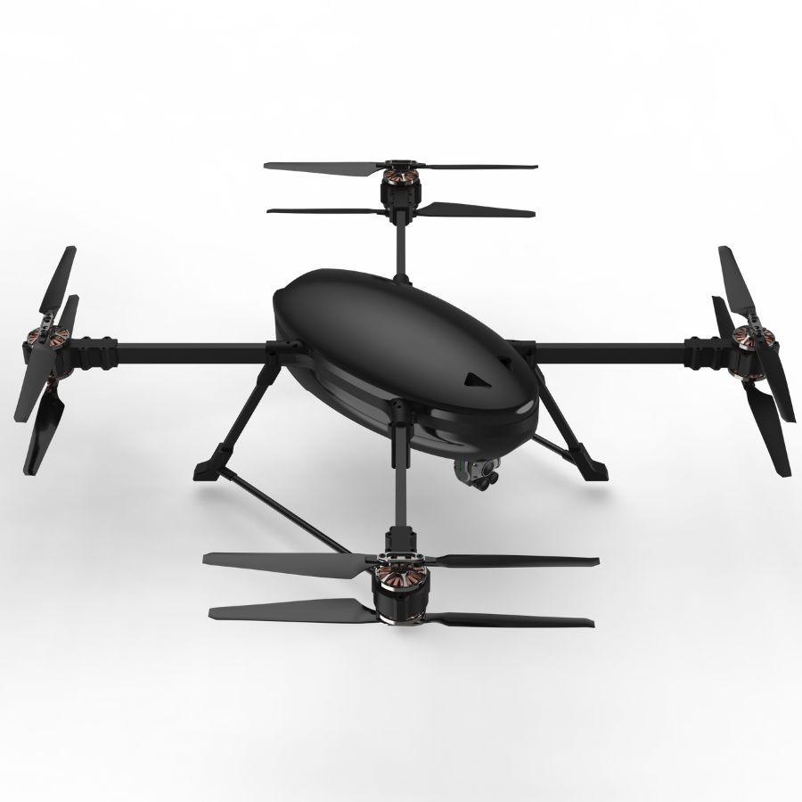
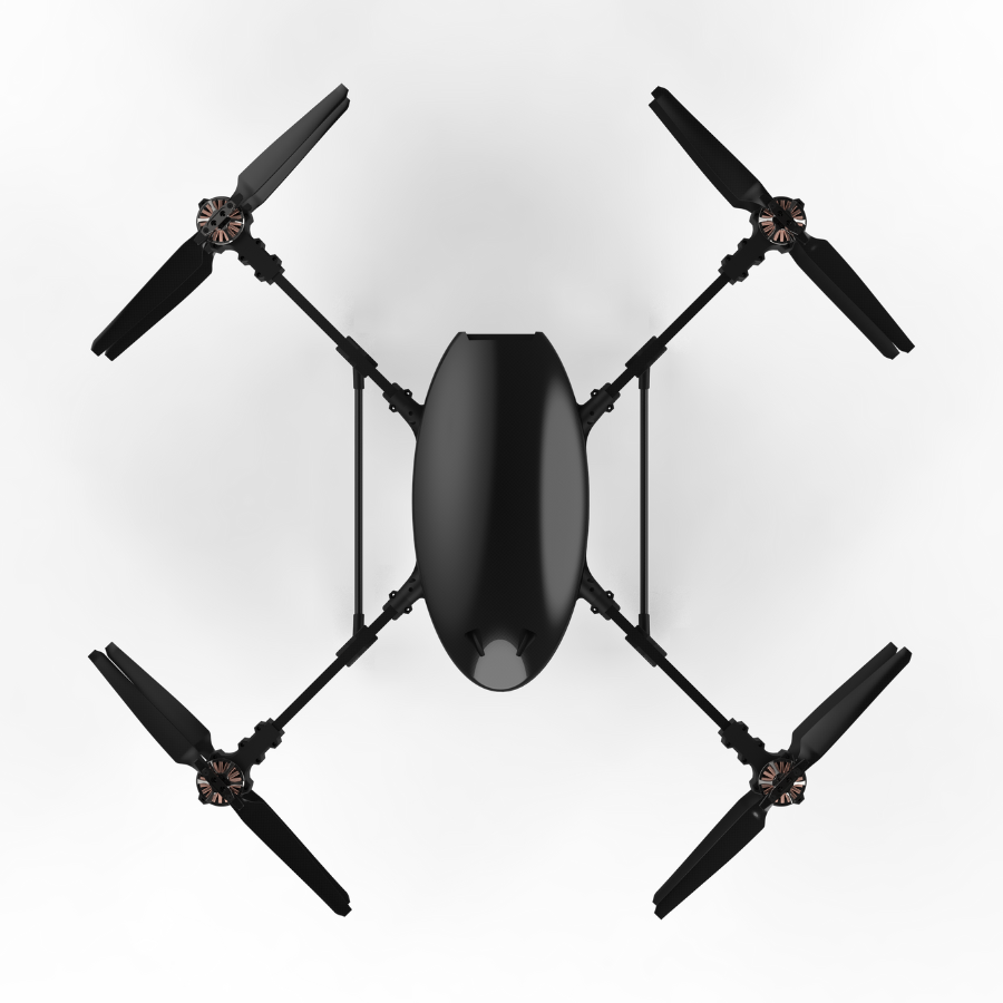
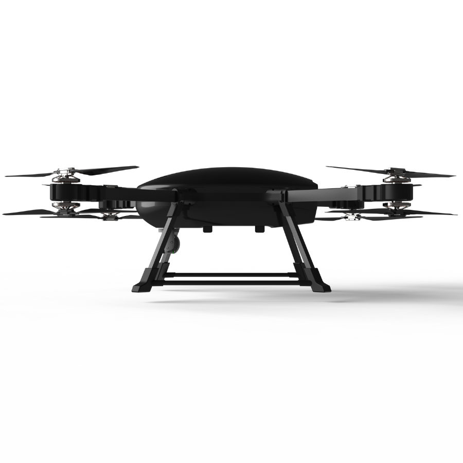
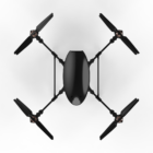
Compact Design
Featuring an innovative coaxial motor setup, this ultra-compact design delivers exceptional performance in a highly portable form.
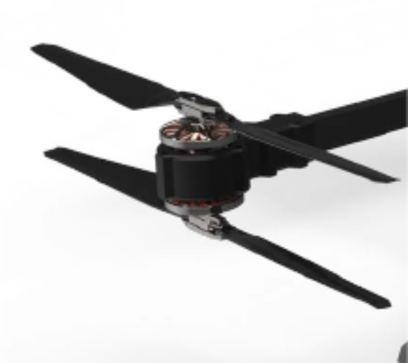
Co-Axial Configuration
Equipped with a co-axial setup, it offers dual redundancy, ensuring the drone stays functional in any situation
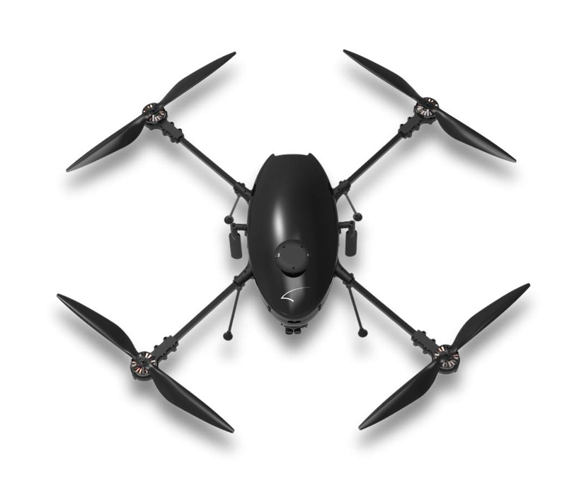
Rugged Airframe
With a co-axial configuration providing dual redundancy, this drone ensures continuous operation in any situation. Its durable construction reduces downtime, enhances longevity, and safeguards internal components, delivering top performance even in the most challenging environments
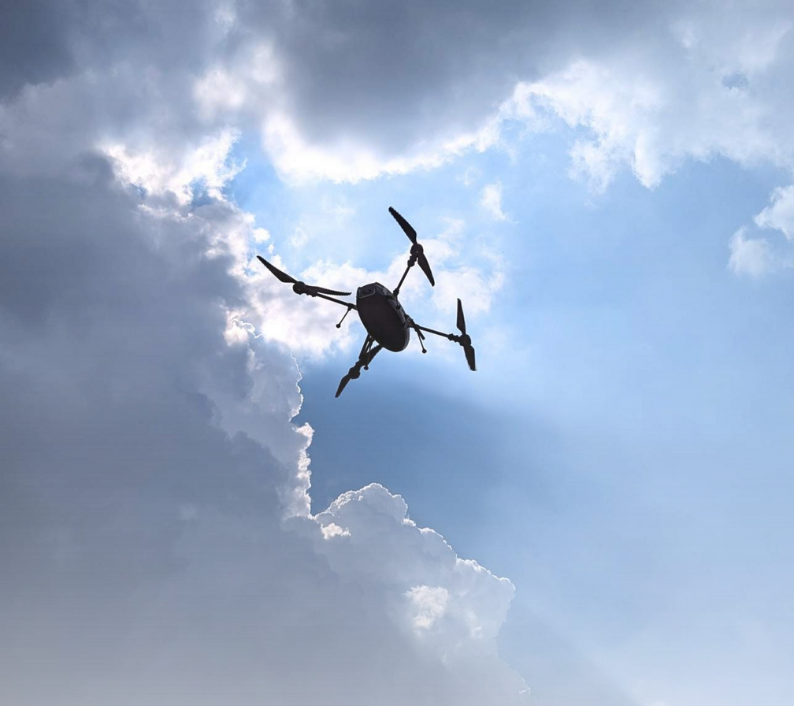
Up to 24 Hours of True Endurance
Experience revolutionary aerial surveillance with continuous flight time, allowing extended monitoring without the need for frequent landings.
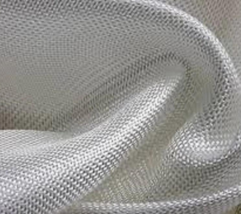
Composite Material
Constructed from advanced composite materials, it features a durable structure designed to enhance the UAV’s lifespan.
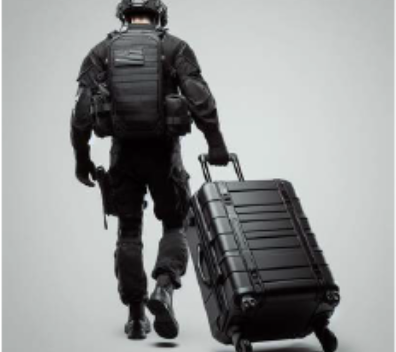
Highly Portable
Built from advanced composite materials for a robust structure that extends the UAV’s lifespan. Its compact design ensures easy portability, allowing users to conveniently carry it in the provided side bag.
Specifications
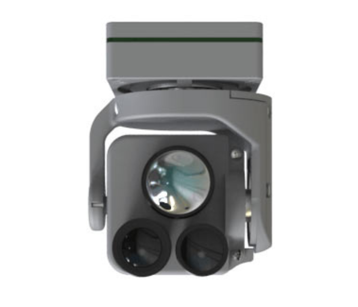
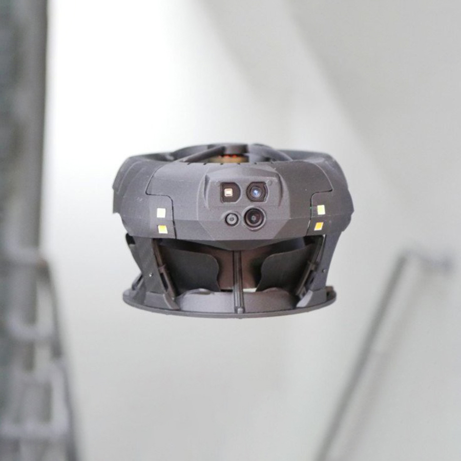
EO-IR Dual vision Payload
Visible Camera Resolution: 1920
X 1080 P
Thermal resolution: 640 X 480P
Visible Camera Zoom: 40X
Control Range (PTZ): -45°C to
+135°C(Tilt), -180°C to +180°C
(Pan)
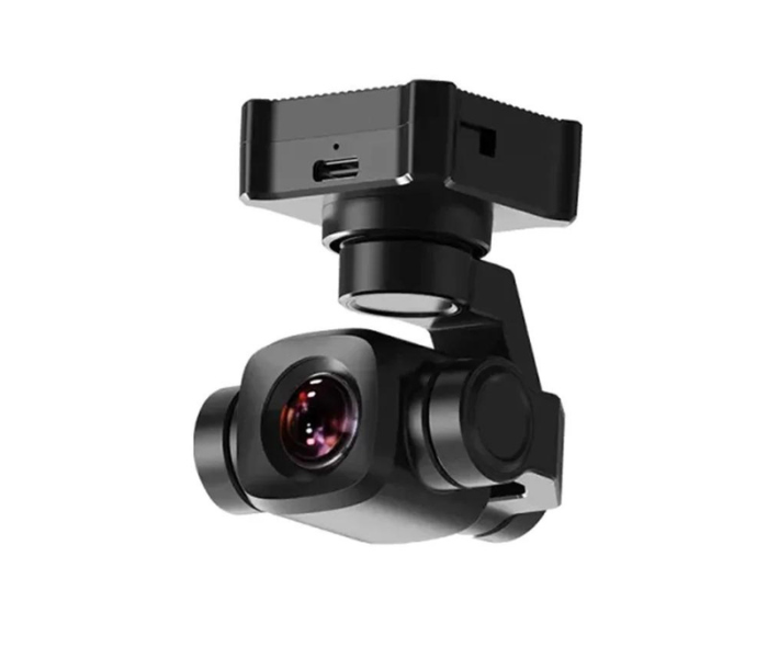
RGB Day Payload
Visible Camera Resolution : 4K @
30fps
Visible Camera Zoom : 6X (Digital)
1/1.7-inch Sony sensor
HDR and starlight night vision
3-axis gimbal stabilization
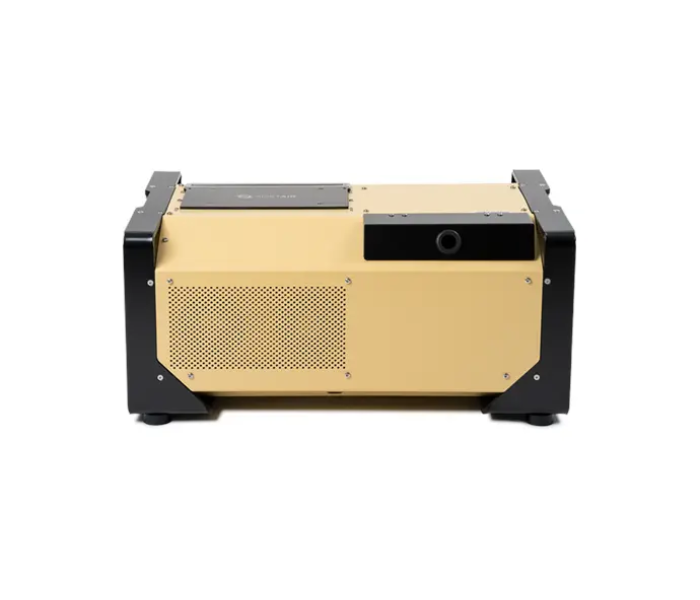
100 m Tethered Box
Micro tether length: 100 m
Tether weight: 16 g/m
Power output: 2200 W
Tensile Strength: 120-150 daN
Micro Tether management:
Electric and Manual switch
Dimensions: 408 x 603 x 261 mm
Portable Power Source: 230 VAC,
50-60 Hz (4 kW min), 120 VAC,
50-60 Hz (3 kW min)
Rugged Structure: IP54 Certified
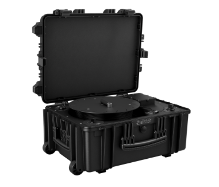
70 m Tethered Box
Micro tether length: 70 m
Tether weight: 16 g/m
Power output: 1500 W
Tensile Strength: 100 daN
Micro Tether management:
Electric and Manual switch
Dimensions: 627 x 475 x 292 mm
Portable Power Source: 230 VAC,
50-60 Hz (4 kW min), 120 VAC,
50-60 Hz (3 kW min)
Portability: Telescopic handle
and wheels
Accomplish your missions with ease
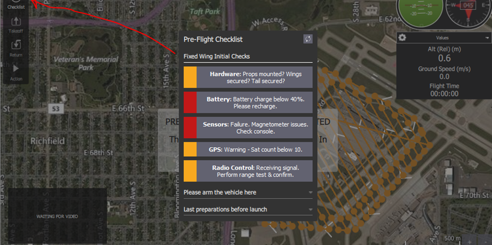
Pre-flight check
It features an advanced PreFlight Check, meticulously evaluating crucial parameters before takeoff.

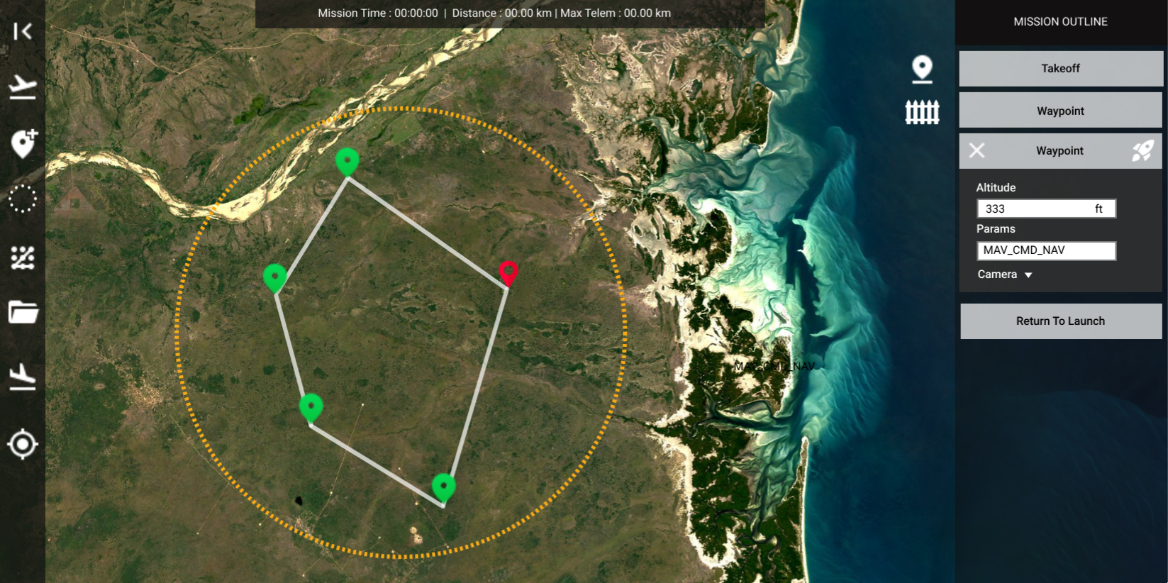
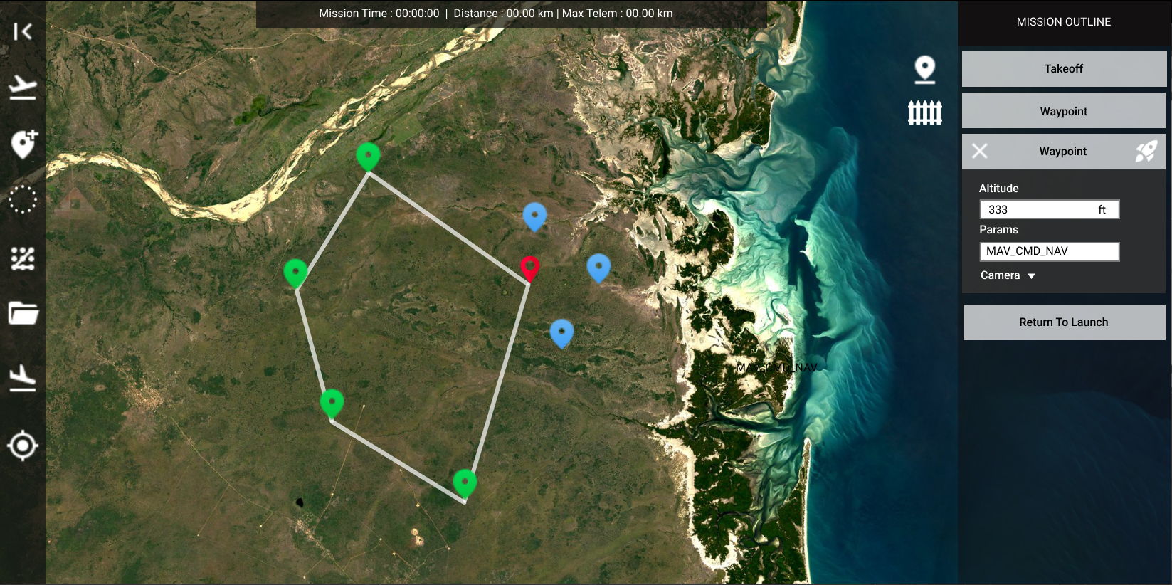
Plan missions with ease
Armed with the latest geographical terrain data, you can optimize your missions by flying at a constant height above the terrain, ensuring you’ll never run into it.
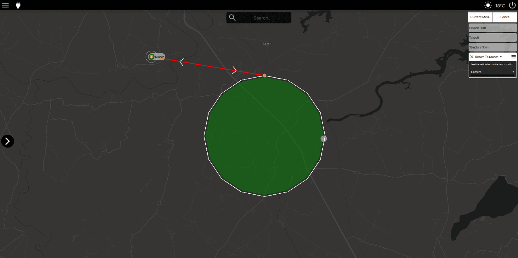
Absolute Safety
Implemented with failsafe to safeguard your UAVs during emergencies like low battery or RC link loss. Effortlessly establish geofences to prohibit your UAVs from entering restricted zones.
Structure scans
Structure scans allow you to assess the condition of any structure, plan maintenance and much more which can be fine-tuned for any structure.
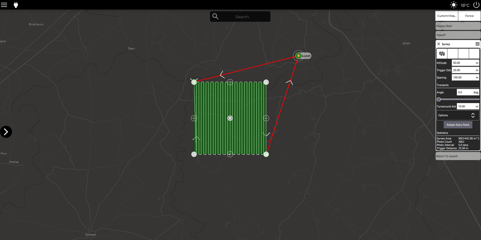
Survey scans
Utilize survey scans to thoroughly examine an area of choice. Choose from predefined patterns or create your own with our tracing tool.
Failsafe feature
It protects UAVs in the event of an emergency such as battery low, RC link loss. Easily create geofences to prevent your UAVs from flying into restricted areas
Specifications
Physical Characteristics
| Specification | Details |
|---|---|
| Dimensions (without propellers) | 52 X 52 X 30 cm |
| Dimensions (with propellers) | 94 X 94 X 30 cm |
| Max take-off weight (with battery and payload) | ≤ 6 kg |
| Empty weight (without battery and with payload) | ≤ 5.3 kg |
| Empty weight (without battery and payload) | ≤ 5 kg |
| Max payload capacity | 750 g |
| Payload ground clearance | 25 mm (Variable) |
| Propeller type | Non-foldable |
| Configuration | Co-axial quadcopter |
| Propeller size (size and pitch) | 15″ X 5.0“ (upper), 16” X 10″ (lower) |
| Airframe make | Carbon fibre and Nylon |
Performance Characteristics
| Specification | Details |
|---|---|
| True Endurance™ (with payload) | Up to 24 hours |
| Composite material | |
| Command and control range | 100/70 m |
| Live Video Transmission | 100/70 m |
| Max take-off altitude (AMSL) | 4000 m |
| Max flight altitude (AGL) | 100/70 m |
| Operating temperature range | -20°C to +60°C |
| Wind resistance | 12 m/s (20 knots) |
| Ascend speed | 2 m/s |
| Descend speed | 1 m/s |
| Deployment time | < 5 minutes |
| Packaging Time (After landing) | < 10 minutes |
| Aural Signature | < 60 dB at 300 ft |
| Launch type | Autonomous vertical take-off and landing |
| Max space required for recovery | 2.5 m X 2.5 m |
| Flight modes | Fully autonomous from take-off to landing without using any R/C controller, Altitude hold, Remote piloted mode for video-based navigation (RPV mode) |
| Failsafe features | Return to Home on communication failure, Return to Home/Land on tether breakage, Multiple GPS on-board for GPS failure redundancy, High wind indication, High wind fail-safe, Return to land on power cutout |
| Extra features | Plug and perform tether system |
Datalink Characteristics
| Specification | Details |
|---|---|
| Communication Link Capability | Transmit control commands, telemetry data, day and night video from UAV to GCS |
| Video Output | Ethernet |
| Video Link | Digital and Encrypted |
| Frequency Band | 2.4 GHz band or 5.8 GHz band |
| Number of Channels | 16 communication channels |
Payload - I (Day-Night dual vision)
| Specification | Details |
|---|---|
| Dimensions (L x W x H) | 57 x 52 x 88 mm |
| Weight | 235 g |
| Gimbal | 3-axis mechanical |
| Control Range | Pitch: -90° to +135°, Yaw: -165° to +165°, Roll: -45° to +45° |
| Day Camera: | |
| Resolution | 1920 x 1080P |
| Zoom | 20x & 2x digital (total 40x), Continuous zoom |
| Field of View | HFOV: 60°, WFOV: 3°, NFOV: 1.5° |
| Night Camera: | |
| Resolution | 640 x 480 |
| Zoom | 4x continuous digital |
| Detection & Tracking | 2 km (Day), 800 m (Night) |
Payload - II (Day-Night dual vision)
| Specifications | Details |
|---|---|
| Dimensions (LxWxH) | 118 x 92 x 159.88 mm |
| Weight | 730 g |
| Gimbal | 3-axis mechanical |
| Gimbal Pitch | -45° to +95° |
| Gimbal Yaw | ±300° to ±365° |
| Gimbal Roll | ±70° |
| Control Range | 2 km (Day) |
| Day Camera Resolution | 1920 x 1080P |
| Day Camera Zoom | 10x optical & 32x digital |
| Day Camera Field of View | HFOV: 54°, DFOV: 68°, VFOV: 31° |
| Night Camera Resolution | 640 x 512 |
| Night Camera Zoom | 8x continuous digital |
| Night Detection & Tracking | 800 m |
Payload - III (Day vision only)
| Specifications | Details |
|---|---|
| Dimensions (LxWxH) | 100 x 77 x 105 mm |
| Weight | 365 g |
| Gimbal | 3-axis mechanical |
| Gimbal Pitch | -45° to +45° |
| Gimbal Yaw | +240° to -240° |
| Gimbal Roll | +45° to -100° |
| Day Camera Effective Megapixel | 4 MP |
| Day Camera Resolution | 1920 x 1080P |
| Day Camera Zoom | 10x optical |
| Day Camera Field of View | DFOV: 66.6° – 7.2° |
| PAL/NTSC Supported | Yes |
Payload - IV (Day vision only)
| Specifications | Details |
|---|---|
| Dimensions (LxWxH) | 55 x 55 x 70 mm |
| Weight | 95 g |
| Gimbal | 3-axis mechanical |
| Gimbal Pitch | -135° to +45° |
| Gimbal Yaw | -160° to +160° |
| Gimbal Roll | -30° to +30° |
| Day Camera Effective Megapixel | 8 MP |
| Day Camera Resolution | 3840 x 2160P |
| Day Camera Zoom | 6x digital |
| Day Camera Field of View | FOV: 93° |
Tether station - (100 m)
| Specifications | Details |
|---|---|
| Tether Length | 100 m |
| Tether Weight | 16 g/m |
| Tensile Strength | 120-150 daN |
| Power Output | 2200 W |
| Tether Management | Electric and manual winch with various torque |
| Portable Power Source | 230 VAC, 50-60 Hz (4 kW min), 120 VAC, 50-60 Hz (3 kW min) |
| Dimensions | 408 x 603 x 261 mm |
| Tether Box Weight | ≤ 24 kg |
| Rugged Structure | IP54 Certified |
| Operating Temperature | -20°C to +50°C |
| Portability | Yes |
Tether station - (70 m)
| Specifications | Details |
|---|---|
| Tether Length | 70 m |
| Handlebars | Cushioned/Non-cushioned |
| Tether Weight | 16 g/m |
| Tensile Strength | 100 daN |
| Power Output | 1500 W |
| Tether Management | Electric and manual winch with various torque |
| Portable Power Source | 230 VAC, 50-60 Hz (4 kW min), 120 VAC, 50-60 Hz (3 kW min) |
| Dimensions | 627 x 475 x 292 mm |
| Tether Box Weight | ≤ 20 kg |
| Rugged Structure | IP54 Certified |
| Operating Temperature | -20°C to +50°C |
| Portability | Telescopic handle and wheels |
GCS (Ground Control Station) Characteristics
| Specifications | Details |
|---|---|
| Built-in Pre-flight Checks | Yes |
| Features | Failsafe feature, Geo-fencing, etc. |
| GUI Display | Mission planning, Structure scans, Survey scans, Geographic map along with UAV location, UAV trajectory, waypoints, and flight plan. Real-time video from the UAV with on-screen display of key parameters. |
| Real-time Display Parameters | UAV coordinates, target (payload) coordinates, range from UAV, Distance from Home, etc. |
| User Controls | One-click Take-off / Land / Hover, Set the altitude of the UAV, Waypoint navigation, Dynamic flight plan adjustment, Point payload to ground coordinate function, RPV mode for semi-autonomous flying. |
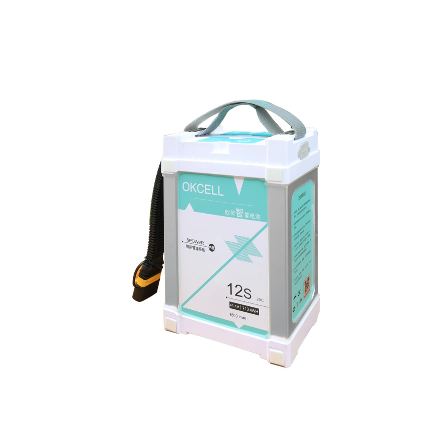
Battery
| Specifications | Details |
|---|---|
| Dimensions (LxWxH) | 137 x 55 x 44 mm |
| Weight | 695 ± 5 g |
| Battery Type | Li-polymer |
| Capacity | 5200 mAh |
| Standard Voltage | 21.6 V |
| Max Charging Voltage | 25.2 V |
| Energy Density | 115.44 Wh |
| Charging Time | 25 minutes at 3C |
| Charging Temperature | 10°C to 45°C |
| Storage Temperature | 5°C to 45°C |
| Charging Cycle | 200 cycles |
FAQ’s
How does the TAR™️ Tethered Drone System enhance security for critical infrastructure over long periods?
The TAR™️ drone’s 24-hour continuous flight time, combined with its tethered power source, enables non-stop surveillance of critical infrastructure, such as power plants or airports. Its EO-IR dual vision payload allows for high-resolution visible and thermal imaging, ensuring that operators can monitor these areas for potential threats or malfunctions in real-time, even during low-visibility conditions like night or fog.
Can the TAR™️ drone be used for detailed structural inspections, and how does it handle complex maintenance tasks?
Yes, TAR is equipped with structure scan capabilities, which allow it to assess the condition of buildings, bridges, power lines, and pipelines. Operators can utilize its stabilized camera with 40X zoom and thermal imaging to detect fine cracks, hotspots, or other issues in hard-to-reach areas. The drone’s ability to maintain precise positioning and gather real-time data is invaluable for planning preventive maintenance, reducing downtime, and ensuring operational safety.
In what ways does the TAR™️ drone enhance search and rescue operations, especially in challenging environments?
The TAR™️ drone’s extended flight time, thermal imaging capabilities, and 100-meter tether make it ideal for continuous search and rescue missions in complex terrains or low-visibility conditions, such as forests or mountainous regions. Its RGB day payload with HDR night vision allows for clear imaging even in low-light scenarios, helping rescue teams locate individuals faster. Additionally, the drone’s quick deployment time and failsafe features ensure rapid, reliable operations in emergencies.
How does the TAR™️ drone maintain consistent data transmission and power supply during extended missions in remote areas?
The TAR™️ drone is powered via a tether that not only supplies continuous electrical power but also ensures stable, real-time data transmission to ground control stations, even in remote or difficult-to-reach locations. This makes it an excellent tool for long-term monitoring of remote sites such as wildlife reserves or disaster zones, where it can be deployed without concerns about battery depletion or data loss.
What advantages does the co-axial motor configuration provide in high-risk environments, such as disaster zones or areas with extreme weather conditions?
The dual-redundant co-axial motor setup ensures that the TAR™️ drone remains operational even if one motor fails, providing an extra layer of safety and reliability during missions in hazardous environments. Whether deployed in disaster zones or areas prone to strong winds, the co-axial system enhances the drone’s stability and minimizes the risk of operational failure, allowing for consistent performance in critical situations.
How can the TAR™️ Tethered Drone be integrated into power line and pipeline monitoring to improve maintenance efficiency?
The TAR™️ drone’s tethered system allows for prolonged, real-time inspections of power lines and pipelines, enabling operators to identify anomalies such as leaks or overheating. Its thermal and visible imaging capabilities allow detailed assessment of structural integrity while reducing the need for on-ground inspection teams, making it a cost-effective solution for large-scale utility monitoring and preventive maintenance.
What specific features make the TAR™️ drone suitable for wildlife conservation and environmental monitoring applications?
For wildlife conservation, the TAR™️ drone can perform long-duration surveillance, tracking migration patterns or poaching activities without disturbing the animals. Its infrared thermal imaging is particularly useful for monitoring animal activity at night. In environmental monitoring, its ability to detect temperature anomalies through thermal vision allows early identification of forest fires or pollution events, providing critical data for early intervention and disaster prevention.


There are no reviews yet.